Nong Hin District
Nong Hin
หนองหิน | |
|---|---|
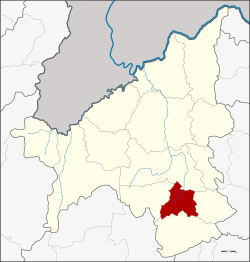 District location in Loei Province | |
| Coordinates: 17°7′24″N 101°51′30″E / 17.12333°N 101.85833°ECoordinates: 17°7′24″N 101°51′30″E / 17.12333°N 101.85833°E | |
| Country | Thailand |
| Province | Loei |
| Seat | Nong Hin |
| Area | |
| • Total | 435.0 km2 (168.0 sq mi) |
| Population (2005) | |
| • Total | 23,255 |
| • Density | 53.5/km2 (139/sq mi) |
| Time zone | UTC+7 (ICT) |
| Postal code | 42190 |
| Geocode | 4214 |

Nong Hin (Thai: หนองหิน; IPA: [nɔ̌ːŋ hǐn]) is a district (amphoe) of Loei Province, northeastern Thailand.
Geography[]
Neighboring districts are (from the north clockwise) Wang Saphung, Pha Khao, Phu Kradueng, and Phu Luang.
History[]
The minor district (king amphoe) was established on 1 July 1997 with territory split off from Phu Kradueng District.[1]
On 15 May 2007, all 81 minor districts in Thailand were upgraded to full districts.[2] On 24 August, the upgrade became official.[3]
Administration[]
The district is divided into three sub-districts (tambons), which are further subdivided into 34 villages (mubans). Nong Hin is a township (thesaban tambon) which covers parts of tambon Nong Hin. There are a further three tambon administrative organizations (TAO).
| No. | Name | Thai name | Villages | Pop. | |
|---|---|---|---|---|---|
| 1. | หนองหิน | 14 | 9,711 | ||
| 2. | ตาดข่า | 5 | 4,060 | ||
| 3. | ปวนพุ | 15 | 9,484 |
References[]
- ^ ประกาศกระทรวงมหาดไทย เรื่อง แบ่งเขตท้องที่อำเภอภูกระดึง จังหวัดเลย ตั้งเป็นกิ่งอำเภอหนองหิน (PDF). Royal Gazette (in Thai). 118 (Special 51 ง): 19. 25 June 1997.
- ^ แถลงผลการประชุม ครม. ประจำวันที่ 15 พ.ค. 2550 (in Thai). Manager Online.
- ^ พระราชกฤษฎีกาตั้งอำเภอฆ้องชัย...และอำเภอเหล่าเสือโก้ก พ.ศ. ๒๕๕๐ (PDF). Royal Gazette (in Thai). 124 (46 ก): 14–21. 24 August 2007.
External links[]
This Loei Province location article is a stub. You can help Wikipedia by . |
- Amphoe of Loei Province
- Isan geography stubs