Pak Chom District
Pak Chom
ปากชม | |
|---|---|
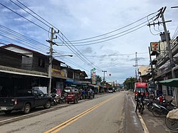 Street in Pak Chom | |
 District location in Loei Province | |
| Coordinates: 18°1′18″N 101°53′18″E / 18.02167°N 101.88833°ECoordinates: 18°1′18″N 101°53′18″E / 18.02167°N 101.88833°E | |
| Country | Thailand |
| Province | Loei |
| Seat | Pak Chom |
| Area | |
| • Total | 957.0 km2 (369.5 sq mi) |
| Population (2005) | |
| • Total | 37,934 |
| • Density | 39.6/km2 (103/sq mi) |
| Time zone | UTC+7 (ICT) |
| Postal code | 42150 |
| Geocode | 4204 |

Pak Chom (Thai: ปากชม, pronounced [pàːk t͡ɕʰōm]) is the northeasternmost district (amphoe) of Loei Province, northeastern Thailand.
History[]
The minor district (king amphoe) Pak Chom was created on 1 September 1967, when the three tambons, Pak Chom, Hat Khamphi, and Chiang Klom, were split off from Chiang Khan District.[1] It was upgraded to a full district in 1971.[2]
Geography[]
Neighboring districts are (from the east clockwise): Sangkhom of Nong Khai Province; Na Yung, Nam Som of Udon Thani Province; Na Duang, Mueang Loei, and Chiang Khan of Loei Province. To the north is Vientiane Province of Laos.
The important water resources are the Mekong and Rivers.
Administration[]
The district is divided into six communes (tambons), which are further subdivided into 50 villages (mubans). There are two townships (thesaban tambons). Pak Chom and Chiang Klom each cover parts of the same-named tambons. There are a further six tambon administrative organizations (TAO).
| No. | Name | Thai name | Villages | Pop. | |
|---|---|---|---|---|---|
| 1. | Pak Chom | ปากชม | 12 | 8,426 | |
| 2. | Chiang Klom | เชียงกลม | 10 | 9,683 | |
| 3. | Hat Khamphi | หาดคัมภีร์ | 6 | 3,719 | |
| 4. | Huai Bo Suen | ห้วยบ่อซืน | 6 | 5,128 | |
| 5. | Huai Phichai | ห้วยพิชัย | 10 | 6,755 | |
| 6. | Chom Charoen | ชมเจริญ | 6 | 4,223 |
References[]
- ^ ประกาศกระทรวงมหาดไทย เรื่อง แบ่งท้องที่ตั้งเป็นกิ่งอำเภอ: แบ่งท้องที่อำเภอเชียงคาน ตั้งเป็น กิ่งอำเภอปากชม (PDF). Royal Gazette (in Thai). 84 (90 ง): 2603. 26 September 1967.
- ^ พระราชกฤษฎีกาตั้งอำเภอปลาปาก อำเภอเชียงกลาง อำเภอปากชม อำเภอบ้านม่วง อำเภอพังโคน อำเภอดอนสัก อำเภอพนม อำเภอเวียงสระ อำเภอสังคม และอำเภอหัวตะพาน พ.ศ. ๒๕๑๔ (PDF). Royal Gazette (in Thai). 88 (123 ก): 745–748. 16 November 1971.
External links[]
This Loei Province location article is a stub. You can help Wikipedia by . |
- Amphoe of Loei Province
- Isan geography stubs