Nora Municipality
Nora Municipality
Nora kommun | |
|---|---|
 Nora Railway Station | |
 Coat of arms | |
 | |
| Coordinates: 59°31′N 15°02′E / 59.517°N 15.033°ECoordinates: 59°31′N 15°02′E / 59.517°N 15.033°E | |
| Country | Sweden |
| County | Örebro County |
| Seat | Nora |
| Area | |
| • Total | 690.82 km2 (266.73 sq mi) |
| • Land | 618.49 km2 (238.80 sq mi) |
| • Water | 72.33 km2 (27.93 sq mi) |
| Area as of 1 January 2014. | |
| Population (31 December 2019)[2] | |
| • Total | 10,726 |
| • Density | 16/km2 (40/sq mi) |
| Time zone | UTC+1 (CET) |
| • Summer (DST) | UTC+2 (CEST) |
| ISO 3166 code | SE |
| Province | Västmanland |
| Municipal code | 1884 |
| Website | www.nora.se |

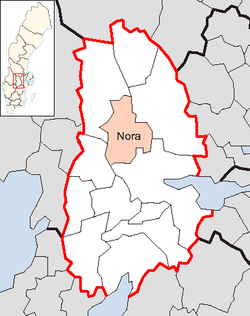
Nora Municipality (Nora kommun) is a municipality in Örebro County in central Sweden. Its seat is located in the city of Nora.
The amalgamation leading to the present municipality took place already in 1967 and in 1971 the City of Nora became a unitary municipality.
Localities[]
Riksdag elections[]
| Year | % | Votes | V | S | MP | C | L | KD | M | SD | NyD | Left | Right |
|---|---|---|---|---|---|---|---|---|---|---|---|---|---|
| 1973[3] | 89.9 | 5,833 | 5.0 | 49.9 | 24.0 | 9.2 | 2.8 | 8.8 | 54.9 | 42.0 | |||
| 1976[4] | 91.5 | 6,277 | 3.9 | 49.0 | 25.8 | 9.7 | 2.2 | 9.3 | 52.9 | 44.8 | |||
| 1979[5] | 90.3 | 6,515 | 4.5 | 49.3 | 20.5 | 9.9 | 2.1 | 12.7 | 53.8 | 43.1 | |||
| 1982[6] | 91.1 | 6,683 | 4.4 | 53.0 | 2.1 | 16.8 | 6.0 | 2.2 | 15.6 | 57.4 | 38.4 | ||
| 1985[7] | 89.3 | 6,594 | 4.4 | 51.7 | 2.1 | 12.3 | 13.6 | 15.8 | 56.1 | 41.7 | |||
| 1988[8] | 85.5 | 6,327 | 5.8 | 49.3 | 5.9 | 10.9 | 11.7 | 3.5 | 12.6 | 61.0 | 35.2 | ||
| 1991[9] | 86.0 | 6,585 | 5.6 | 42.2 | 3.4 | 9.1 | 8.1 | 7.6 | 15.6 | 7.8 | 47.8 | 40.4 | |
| 1994[10] | 86.5 | 6,754 | 7.0 | 50.4 | 5.4 | 7.8 | 7.3 | 4.2 | 16.2 | 1.1 | 62.8 | 35.5 | |
| 1998[11] | 81.4 | 6,332 | 14.1 | 42.1 | 4.2 | 5.7 | 4.5 | 11.4 | 16.2 | 60.4 | 37.8 | ||
| 2002[12] | 79.5 | 6,273 | 9.1 | 45.2 | 4.0 | 7.8 | 11.3 | 8.9 | 11.0 | 1.4 | 58.3 | 39.0 | |
| 2006[13] | 81.1 | 6,362 | 5.5 | 43.1 | 4.6 | 9.0 | 6.7 | 6.2 | 18.6 | 4.1 | 53.2 | 40.5 | |
| 2010[14] | 84.9 | 6,745 | 4.5 | 40.4 | 6.1 | 6.2 | 6.4 | 5.5 | 24.2 | 5.8 | 51.0 | 42.3 | |
| 2014[15] | 85.9 | 6,924 | 5.4 | 39.5 | 5.1 | 7.5 | 3.5 | 3.9 | 16.4 | 15.4 | 50.0 | 31.4 | |
| 2018[16] | 86.9 | 6,922 | 6.3 | 33.7 | 3.4 | 8.9 | 3.6 | 6.3 | 14.7 | 21.2 | 52.3 | 46.0 |
Twin towns[]
Nora's twin towns with the year of its establishing:
See also[]
- Nora, Indianapolis (named after Nora in Sweden)
- Nora Township, Clearwater County, Minnesota
- Nora Township, Pope County, Minnesota
References[]
- ^ "Statistiska centralbyrån, Kommunarealer den 1 januari 2014" (in Swedish). Statistics Sweden. 2014-01-01. Archived from the original (Microsoft Excel) on 2016-09-27. Retrieved 2014-04-18.
- ^ "Folkmängd i riket, län och kommuner 31 december 2019" (in Swedish). Statistics Sweden. February 20, 2020. Retrieved February 20, 2020.
- ^ "Allmänna valen 1973" (PDF) (in Swedish). SCB.
- ^ "Allmänna valen 1976" (PDF) (in Swedish). SCB.
- ^ "Allmänna valen 1979" (PDF) (in Swedish). SCB.
- ^ "Allmänna valen 1982" (PDF) (in Swedish). SCB.
- ^ "Allmänna valen 1985" (PDF) (in Swedish). SCB.
- ^ "Allmänna valen 1988" (PDF) (in Swedish). SCB.
- ^ "Allmänna valen 1991" (PDF) (in Swedish). SCB.
- ^ "Allmänna valen 1994" (PDF) (in Swedish). SCB.
- ^ "Allmänna valen 1998" (PDF) (in Swedish). SCB.
- ^ "Nora - summering" (in Swedish). Valmyndigheten.
- ^ "Nora - Allmänna val 17 september 2006" (in Swedish). Valmyndigheten.
- ^ "Nora - Röster Val 2010" (in Swedish). Valmyndigheten.
- ^ "Nora - Röster Val 2014" (in Swedish). Valmyndigheten.
- ^ "Nora - Röster Val 2018" (in Swedish). Valmyndigheten.
- ^ "Sõprusvallad" (in Estonian). Kõo Parish. Archived from the original on 20 July 2011. Retrieved 24 May 2010.
External links[]
| Wikimedia Commons has media related to Nora Municipality. |
- Nora Municipality - Official site
Places adjacent to Nora Municipality | |
|---|---|
Municipalities and seats of Örebro County | ||
|---|---|---|
| Municipalities | ||
| Municipal seats | ||
Categories:
- Municipalities of Örebro County