North Baikal Highlands
| North Baikal Highlands | |
|---|---|
| Северо-Байкальское нагорье / Хойто-Байгалай хадалиг газар | |
 View of the highest area of the highlands | |
| Highest point | |
| Peak | Inyaptuk Golets |
| Elevation | 2,514 m (8,248 ft) |
| Coordinates | 56°24′14″N 111°5′7″E / 56.40389°N 111.08528°E |
| Dimensions | |
| Length | 400 km (250 mi) |
| Width | 150 km (93 mi) |
| Geography | |
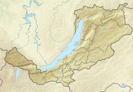 Location in Buryatia, Russia | |
| Country | Russia |
| Federal subject | Irkutsk Oblast/ Buryatia |
| Range coordinates | 56°20′N 111°0′E / 56.333°N 111.000°ECoordinates: 56°20′N 111°0′E / 56.333°N 111.000°E |
| Parent range | South Siberian System |
| Geology | |
| Orogeny | Alpine orogeny |
| Age of rock | Early Proterozoic and Late Riphean[1] |
| Type of rock | Metamorphic rocks, granite intrusions |
| Climbing | |
| Easiest route | From Mama |
The North Baikal Highlands (Russian: Северо-Байкальское нагорье; Buryat: Хойто-Байгалай хадалиг газар)[2] are a mountainous area in Eastern Siberia, Russia. Administratively the territory of the uplands is part of Buryatia and Irkutsk Oblast.[3]
The nearest airport is Mama Airport.[3]
History[]
Between 1855 and 1858 (d. 1884) took part in the Eastern Siberian expedition led by Russian astronomer and traveler Ludwig Schwarz. In 1857 he mapped the Kirenga River and, while exploring its right tributary, the , Kryzhin discovered the formerly unknown rising above the area of its source.[4]
Between 1909 and 1911 the North Baikal Highlands were explored by Russian geologist (1874 - 1944). He surveyed the river valleys of the area, all of them tributaries of the Lena basin, including the , Chaya, the Chuya, Kirenga and its right tributaries, as well as the Mama.[5]
Preobrazhensky's trip very nearly ended in tragedy when his boat crashed and capsized while navigating down the Chaya River. Badly injured and shaken, Pavel and his team almost lost their lives and their valuable equipment sank. Despite the difficulties, Preobrazhensky managed to map the area cutting across several places and outlining the entire North Baikal Highlands. His data revealed that it was a complex system of distinct high massifs, gathered either in small irregular groups or in short ridges, that were separated from each other by deep and narrow valleys. In the western part of the North Baikal mountainous land he mapped for the first time a 175 kilometers (109 mi) stretch of the Akitkan Range.[6]
Geography[]
The North Baikal Highlands are separated from the Patom Highlands to the northeast by river Vitim, a tributary of the Lena. The highlands stretch southwards to the Upper Angara Range and southeastwards to the Delyun-Uran Range. To the northwest begins the Central Siberian Plateau and to the east the Delyun-Uran Range of the Stanovoy Highlands. The average altitudes range between 1,000 meters (3,300 ft) and 1,600 meters (5,200 ft) with narrow valleys in between that coincide with tectonic faults across the highlands.[7]
The highest point is 2,514 metres (8,248 ft) high Golets Inyaptuk in the southern part,[8] located at 56°24′14″N 111°5′7″E / 56.40389°N 111.08528°E in the Buryatian zone of the highlands. There are clear traces of ancient glaciation in the uppermost parts of the ranges.[2]
The main subranges are:
- Synnyr Massif (Сынныр), highest point 2,578 metres (8,458 ft)
- (хребет Акиткан), highest point 2,067 metres (6,781 ft)
- (хребет Унгдар), highest point 2,293 metres (7,523 ft)
- Upper Angara Range (Верхнеангарский хребет), highest point 2,641 metres (8,665 ft)
Hydrography[]
The rivers of the North Baikal Highlands belong to the Baikal and Lena basins. Their valleys are deep. The main ones are the 512 kilometers (318 mi) long Chuya, the 353 kilometers (219 mi) long Chaya, the 231 kilometers (144 mi) long , the 176 kilometers (109 mi) long , the 162 kilometers (101 mi) long , the 155 kilometers (96 mi) long , the 141 kilometers (88 mi) long , the 125 kilometers (78 mi) long , the 115 kilometers (71 mi) long and the 97 kilometers (60 mi) long . The highland area is marked by permafrost.
Flora[]
There are taiga forests of conifers, mostly larch, in the slopes of the mountains. At higher altitudes there is mountain tundra. Further up the mountaintops are either flat or topped by golets-type bare rocky summits.[2]
See also[]
References[]
- ^ Schematic geological structure of the North Baikal nickeliferous province (Konnikov et al., 1994)
- ^ a b c Северо-Байкальское нагорье; Great Soviet Encyclopedia in 30 vols. — Ch. ed. A.M. Prokhorov. - 3rd ed. - M. Soviet Encyclopedia, 1969-1978.(in Russian)
- ^ a b Google Earth
- ^ and . Essays on the History of Geographical Discoveries, 3rd ed. in 5 volumes, M., 1982 - 86, Vol. 4 Geographical discoveries and researches of the Modern Era (XIX - the beginning of the XX century), M., 1985, pp. 60, 95 - 96.
- ^ Физическая география СССР - Байкальско-Становая область
- ^ Preobrazhensky, Pavel Ivanovich — "Historical Encyclopedia of Siberia" (2009)
- ^ Акиткан- дивная страна к северу от Байкала.
- ^ Физическая география СССР
External links[]
 Media related to North Baikal Highlands at Wikimedia Commons
- Petrogenesis and age of felsic volcanics of the North-Baikal volcanic-plutonic belt
- Prominent Geologists - VSEGEI Portrait Gallery
- Северо-Байкальское нагорье - Tourism
- History of Exploration (in Russian)
- Mountains of Russia
- Landforms of Irkutsk Oblast
- Landforms of Buryatia
- South Siberian Mountains