North Collins (village), New York
North Collins, New York
Rose's Corners Kerr's Corners | |
|---|---|
Village | |
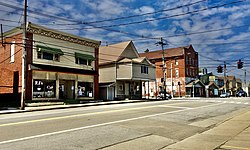 The village center as seen in April 2021 | |
 Location in Erie County and the state of New York | |
| Coordinates: 42°35′41″N 78°56′15″W / 42.59472°N 78.93750°WCoordinates: 42°35′41″N 78°56′15″W / 42.59472°N 78.93750°W | |
| Country | United States |
| State | New York |
| County | Erie |
| Town | North Collins |
| Area | |
| • Total | 0.80 sq mi (2.07 km2) |
| • Land | 0.80 sq mi (2.07 km2) |
| • Water | 0.00 sq mi (0.00 km2) |
| Elevation | 827 ft (252 m) |
| Population (2010) | |
| • Total | 1,232 |
| • Estimate (2019)[2] | 1,195 |
| • Density | 1,491.89/sq mi (575.98/km2) |
| Time zone | UTC-5 (Eastern (EST)) |
| • Summer (DST) | UTC-4 (EDT) |
| ZIP code | 14111 |
| Area code(s) | 716 |
| FIPS code | 36-51792 |
| GNIS feature ID | 0958754 |
| Website | www |

North Collins is a village in Erie County, New York, United States. The population was 1,232 at the 2010 census. The village is in the northwest corner of the town of North Collins.
History[]
The community was formerly known as "Rose's Corners" and "Kerr's Corners". The village of North Collins was incorporated in 1911, setting itself off from the town of North Collins.
In May 2008, the village board agreed to move toward dissolution of the village and become again part of the town of North Collins.
Athletic tradition[]
This section does not cite any sources. (June 2021) |
The town has produced some notable athletes. Perhaps the best-known is Marion Fricano, a former major league baseball player who played for the Philadelphia/Kansas City Athletics (now Oakland Athletics) from 1952 to 1955. His most notable achievement was breaking up a no-hitter with a bunt.
North Collins High School is a Class D member of Section VI of the NYSPHSAA. Since 1960, the boys soccer team has won 23 sectional titles, as well as the state championship in 1994.
Geography[]
According to the United States Census Bureau, the village has a total area of 0.8 square miles (2.1 km2), all land.
U.S. Route 62 (Main Street) and New York State Route 249 (Brant Road/Sherman Avenue) pass through the village.
Demographics[]
| Historical population | |||
|---|---|---|---|
| Census | Pop. | %± | |
| 1880 | 421 | — | |
| 1890 | 636 | 51.1% | |
| 1920 | 1,158 | — | |
| 1930 | 1,165 | 0.6% | |
| 1940 | 1,182 | 1.5% | |
| 1950 | 1,325 | 12.1% | |
| 1960 | 1,574 | 18.8% | |
| 1970 | 1,675 | 6.4% | |
| 1980 | 1,496 | −10.7% | |
| 1990 | 1,335 | −10.8% | |
| 2000 | 1,079 | −19.2% | |
| 2010 | 1,232 | 14.2% | |
| 2019 (est.) | 1,195 | [2] | −3.0% |
| U.S. Decennial Census[3] | |||
At the 2000 census there were 1,079 people, 414 households, and 284 families living in the village. The population density was 1,347.8 people per square mile (520.8/km2). There were 494 housing units at an average density of 617.1 per square mile (238.4/km2). The racial makeup of the village was 89.71% White, 1.20% Black or African American, 3.80% Native American, 1.30% Asian, 1.20% from other races, and 2.78% from two or more races. Hispanic or Latino of any race were 5.19%.[4]
Of the 414 households 34.5% had children under the age of 18 living with them, 51.0% were married couples living together, 12.6% had a female householder with no husband present, and 31.2% were non-families. 25.1% of households were one person and 11.4% were one person aged 65 or older. The average household size was 2.58 and the average family size was 3.11.
The age distribution was 27.9% under the age of 18, 6.3% from 18 to 24, 31.9% from 25 to 44, 20.7% from 45 to 64, and 13.3% 65 or older. The median age was 36 years. For every 100 females, there were 101.7 males. For every 100 females age 18 and over, there were 99.5 males.
The median household income was $38,750 and the median family income was $47,679. Males had a median income of $36,136 versus $23,125 for females. The per capita income for the village was $16,528. About 5.9% of families and 9.3% of the population were below the poverty line, including 11.6% of those under age 18 and 2.6% of those age 65 or over.
References[]
- ^ "2019 U.S. Gazetteer Files". United States Census Bureau. Retrieved July 27, 2020.
- ^ a b "Population and Housing Unit Estimates". United States Census Bureau. May 24, 2020. Retrieved May 27, 2020.
- ^ "Census of Population and Housing". Census.gov. Retrieved June 4, 2015.
- ^ "U.S. Census website". United States Census Bureau. Retrieved 2008-01-31.
External links[]

- Villages in New York (state)
- Buffalo–Niagara Falls metropolitan area
- Villages in Erie County, New York