North Haledon, New Jersey
North Haledon, New Jersey | |
|---|---|
| Borough of North Haledon | |
 Map of North Haledon in Passaic County. Inset: Location of Passaic County highlighted in the State of New Jersey. | |
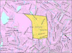 Census Bureau map of North Haledon, New Jersey | |
| Coordinates: 40°57′49″N 74°11′07″W / 40.963618°N 74.185281°WCoordinates: 40°57′49″N 74°11′07″W / 40.963618°N 74.185281°W[1][2] | |
| Country | |
| State | |
| County | |
| Incorporated | March 20, 1901 |
| Government | |
| • Type | Borough |
| • Body | Borough Council |
| • Mayor | Randolph J. "Randy" George (R, term ends December 31, 2022)[3][4] |
| • Administrator / Municipal clerk | Renate Elatab[5] |
| Area | |
| • Total | 3.53 sq mi (9.14 km2) |
| • Land | 3.46 sq mi (8.97 km2) |
| • Water | 0.06 sq mi (0.17 km2) 1.81% |
| Area rank | 313th of 565 in state 9th of 16 in county[1] |
| Elevation | 302 ft (92 m) |
| Population | |
| • Total | 8,417 |
| • Estimate (2019)[11] | 8,395 |
| • Rank | 271st of 566 in state 13th of 16 in county[12] |
| • Density | 2,436.8/sq mi (940.9/km2) |
| • Density rank | 253rd of 566 in state 11th of 16 in county[12] |
| Time zone | UTC−05:00 (Eastern (EST)) |
| • Summer (DST) | UTC−04:00 (Eastern (EDT)) |
| ZIP Codes | |
| Area code(s) | 973[15] |
| FIPS code | 3403153040[1][16][17] |
| GNIS feature ID | 0885325[1][18] |
| Website | www |

North Haledon (pronounced North HAIL-don[19]) is a borough in Passaic County, New Jersey, United States. As of the 2010 United States Census, the borough's population was 8,417,[8][9][10] reflecting an increase of 497 (+6.3%) from the 7,920 counted in the 2000 Census, which had in turn declined by 67 (-0.8%) from the 7,987 counted in the 1990 Census.[20]
North Haledon was formed as a borough by an act of the New Jersey Legislature on March 20, 1901, from portions of the now-defunct Manchester Township.[21]
Geography[]
According to the United States Census Bureau, the borough had a total area of 3.53 square miles (9.14 km2), including 3.46 square miles (8.97 km2) of land and 0.06 square miles (0.17 km2) of water (1.81%).[1][2]
The borough borders the municipalities of Haledon, Hawthorne, Prospect Park and Wayne in Passaic County; and Franklin Lakes and Wyckoff in Bergen County.[22][23][24]
Demographics[]
| Historical population | |||
|---|---|---|---|
| Census | Pop. | %± | |
| 1910 | 749 | — | |
| 1920 | 887 | 18.4% | |
| 1930 | 2,157 | 143.2% | |
| 1940 | 2,761 | 28.0% | |
| 1950 | 3,550 | 28.6% | |
| 1960 | 6,026 | 69.7% | |
| 1970 | 7,614 | 26.4% | |
| 1980 | 8,177 | 7.4% | |
| 1990 | 7,987 | −2.3% | |
| 2000 | 7,920 | −0.8% | |
| 2010 | 8,417 | 6.3% | |
| 2019 (est.) | 8,395 | [11][25][26] | −0.3% |
| Population sources: 1910-1920[27] 1910[28] 1910-1930[29] 1930-1990[30] 2000[31][32] 2010[8][9][10] | |||
2010 Census[]
The 2010 United States census counted 8,417 people, 3,123 households, and 2,386 families in the borough. The population density was 2,436.8 per square mile (940.9/km2). There were 3,213 housing units at an average density of 930.2 per square mile (359.2/km2). The racial makeup was 91.53% (7,704) White, 1.76% (148) Black or African American, 0.02% (2) Native American, 3.78% (318) Asian, 0.00% (0) Pacific Islander, 1.27% (107) from other races, and 1.64% (138) from two or more races. Hispanic or Latino of any race were 7.46% (628) of the population.[8]
Of the 3,123 households, 27.7% had children under the age of 18; 64.9% were married couples living together; 8.3% had a female householder with no husband present and 23.6% were non-families. Of all households, 20.1% were made up of individuals and 11.8% had someone living alone who was 65 years of age or older. The average household size was 2.67 and the average family size was 3.10.[8]
20.4% of the population were under the age of 18, 6.0% from 18 to 24, 23.6% from 25 to 44, 29.7% from 45 to 64, and 20.3% who were 65 years of age or older. The median age was 45.0 years. For every 100 females, the population had 89.8 males. For every 100 females ages 18 and older there were 87.8 males.[8]
The Census Bureau's 2006-2010 American Community Survey showed that (in 2010 inflation-adjusted dollars) median household income was $103,562 (with a margin of error of +/- $5,006) and the median family income was $107,623 (+/- $8,363). Males had a median income of $71,850 (+/- $10,067) versus $49,038 (+/- $4,709) for females. The per capita income for the borough was $41,694 (+/- $4,002). About 0.7% of families and 2.2% of the population were below the poverty line, including 1.1% of those under age 18 and none of those age 65 or over.[33]
Same-sex couples headed 24 households in 2010, more than double the 10 counted in 2000.[34]
2000 Census[]
As of the 2000 United States Census[16] there were 7,920 people, 2,626 households, and 2,077 families residing in the borough. The population density was 2,300.6 people per square mile (888.9/km2). There were 2,675 housing units at an average density of 777.0 per square mile (300.2/km2). The racial makeup of the borough was 95.03% White, 1.44% African American, 0.06% Native American, 1.00% Asian, 0.95% from other races, and 1.53% from two or more races. Hispanic or Latino of any race were 3.89% of the population.[31][32]
There were 2,626 households, out of which 27.8% had children under the age of 18 living with them, 68.2% were married couples living together, 8.1% had a female householder with no husband present, and 20.9% were non-families. 17.7% of all households were made up of individuals, and 9.6% had someone living alone who was 65 years of age or older. The average household size was 2.79 and the average family size was 3.18.[31][32]
In the borough the population was spread out, with 19.7% under the age of 18, 10.6% from 18 to 24, 25.9% from 25 to 44, 24.2% from 45 to 64, and 19.6% who were 65 years of age or older. The median age was 40 years. For every 100 females, there were 89.3 males. For every 100 females age 18 and over, there were 87.4 males.[31][32]
The median income for a household in the borough was $74,700, and the median income for a family was $80,936. Males had a median income of $52,006 versus $34,854 for females. The per capita income for the borough was $30,322. About 2.4% of families and 4.0% of the population were below the poverty line, including 0.3% of those under age 18 and 4.4% of those age 65 or over.[31][32]
Government[]
Local government[]
North Haledon is governed under the Borough form of New Jersey municipal government, which is used in 218 municipalities (of the 565) statewide, making it the most common form of government in New Jersey.[35] The governing body is comprised of the Mayor and the Borough Council, with all positions elected at-large on a partisan basis as part of the November general election. The Mayor is elected directly by the voters to a four-year term of office. The Borough Council is comprised of six members elected to serve three-year terms on a staggered basis, with two seats coming up for election each year in a three-year cycle.[6] The Borough form of government used by North Haledon is a "weak mayor / strong council" government in which council members act as the legislative body with the mayor presiding at meetings and voting only in the event of a tie. The mayor can veto ordinances subject to an override by a two-thirds majority vote of the council. The mayor makes committee and liaison assignments for council members, and most appointments are made by the mayor with the advice and consent of the council.[36][37]
As of 2020, the Mayor of North Haledon is Republican Randolph J. "Randy" George, whose term of office ends on December 31, 2022. Members of the North Haledon Borough Council are Council President Donna Puglisi (R, 2021), Bruce O. Iacobelli (R, 2022), Rocco Luisi (R, 2020), Raymond T. Melone (R, 2020), George Pomianek (R, 2021) and Keith Salviano (R, 2022).[3][38][39][40][41][42]
Mayor Randy George was criticized by residents for his use of two borough-owned generators in the persistent electric outages during the days following the devastation of Hurricane Sandy to provide power to the refrigerators in his ice cream store, while Police Chief Robert Bracco had used another municipal-owned generator to provide power at his home. A special committee formed of borough council members found that the actions were justifiable in light of the circumstances and enabled them to serve the borough during the emergency, but recommended that rules be established to govern personal use of borough property by municipal employees and officials.[43]
Federal, state and county representation[]
North Haledon is located in the 11th Congressional District[44] and is part of New Jersey's 35th state legislative district.[9][45][46] Prior to the 2010 Census, North Haledon had been part of the 8th Congressional District, a change made by the New Jersey Redistricting Commission that took effect in January 2013, based on the results of the November 2012 general elections.[47]
For the 117th United States Congress, New Jersey's Eleventh Congressional District is represented by Mikie Sherrill (D, Montclair).[48] New Jersey is represented in the United States Senate by Democrats Cory Booker (Newark, term ends 2027)[49] and Bob Menendez (Harrison, term ends 2025).[50][51]
For the 2020–2021 session (Senate, General Assembly), the 35th Legislative District of the New Jersey Legislature is represented in the State Senate by Nellie Pou (D, North Haledon) and in the General Assembly by Shavonda E. Sumter (D, Paterson) and Benjie E. Wimberly (D, Paterson).[52][53]
Passaic County is governed by a seven-member Board of Chosen Freeholders, who are elected at-large to staggered three-year terms office on a partisan basis, with two or three seats coming up for election each year as part of the November general election in a three-year cycle. At a reorganization meeting held in January, the board selects a Director and Deputy Director from among its members to serve for a one-year term.[54] As of 2017, Passaic County's Freeholders are Director Cassandra "Sandi" Lazzara (D, 2018; Woodland Park),[55] Deputy Director Bruce James (D, 2017; Clifton),[56] Assad R. Akhter (D, 2018 - appointed to serve an unexpired term; Paterson),[57] John W. Bartlett (D, 2018; Wayne),[58] Theodore O. Best Jr. (D, 2017; Paterson),[59] Terry Duffy (D, 2019; West Milford),[60] and Pasquale "Pat" Lepore (D, 2019; Woodland Park).[61][62][63][64] Constitutional officers elected on a countywide basis are County Clerk Kristin M. Corrado (R, 2019; Totowa),[65] Sheriff Richard H. Berdnik (D, 2019; Little Falls)[66] and Surrogate Bernice Toledo (D, 2021; Prospect Park).[67][63]
Politics[]
As of March 23, 2011, there were a total of 6,156 registered voters in North Haledon, of which 1,180 (19.2% vs. 31.0% countywide) were registered as Democrats, 2,051 (33.3% vs. 18.7%) were registered as Republicans and 2,923 (47.5% vs. 50.3%) were registered as Unaffiliated. There were 2 voters registered to other parties.[68] Among the borough's 2010 Census population, 73.1% (vs. 53.2% in Passaic County) were registered to vote, including 91.9% of those ages 18 and over (vs. 70.8% countywide).[68][69]
In the 2012 presidential election, Republican Mitt Romney received 64.1% of the vote (2,916 cast), ahead of Democrat Barack Obama with 35.0% (1,593 votes), and other candidates with 0.9% (40 votes), among the 4,584 ballots cast by the borough's 6,364 registered voters (35 ballots were spoiled), for a turnout of 72.0%.[70][71] In the 2008 presidential election, Republican John McCain received 3,016 votes (62.0% vs. 37.7% countywide), ahead of Democrat Barack Obama with 1,678 votes (34.5% vs. 58.8%) and other candidates with 46 votes (0.9% vs. 0.8%), among the 4,864 ballots cast by the borough's 6,241 registered voters, for a turnout of 77.9% (vs. 70.4% in Passaic County).[72] In the 2004 presidential election, Republican George W. Bush received 2,951 votes (62.9% vs. 42.7% countywide), ahead of Democrat John Kerry with 1,567 votes (33.4% vs. 53.9%) and other candidates with 32 votes (0.7% vs. 0.7%), among the 4,692 ballots cast by the borough's 5,831 registered voters, for a turnout of 80.5% (vs. 69.3% in the whole county).[73]
In the 2013 gubernatorial election, Republican Chris Christie received 73.0% of the vote (2,304 cast), ahead of Democrat Barbara Buono with 26.3% (831 votes), and other candidates with 0.7% (22 votes), among the 3,230 ballots cast by the borough's 6,439 registered voters (73 ballots were spoiled), for a turnout of 50.2%.[74][75] In the 2009 gubernatorial election, Republican Chris Christie received 2,169 votes (67.2% vs. 43.2% countywide), ahead of Democrat Jon Corzine with 932 votes (28.9% vs. 50.8%), Independent Chris Daggett with 79 votes (2.4% vs. 3.8%) and other candidates with 20 votes (0.6% vs. 0.9%), among the 3,226 ballots cast by the borough's 6,117 registered voters, yielding a 52.7% turnout (vs. 42.7% in the county).[76]
Education[]
The North Haledon School District serves students in public school for kindergarten through eighth grade.[77] As of the 2018–19 school year, the district, comprised of two schools, had an enrollment of 624 students and 59.3 classroom teachers (on an FTE basis), for a student–teacher ratio of 10.5:1.[78] Schools in the district (with 2018–19 enrollment data from the National Center for Education Statistics[79]) are Memorial School[80] with 344 students in grades K–4 and High Mountain School[81] with 275 students in grades 5–8.[82][83]
For ninth through twelfth grades, public school students attend Manchester Regional High School, which serves students from Haledon, North Haledon, and Prospect Park.[84][85] The school is located in Haledon. The district participates in the Interdistrict Public School Choice Program, which allows non-resident students to attend the district's schools without cost to their parents, with tuition paid by the state. Available slots are announced annually by grade.[86] North Haledon residents had successfully voted in 2003 to leave the district, choosing to send their high school aged students to Midland Park High School in nearby Bergen County, New Jersey. In August 2004, the New Jersey Supreme Court decided against North Haledon, citing that the town's exit from the district would shift the ethnic and racial balance of the high school.[87] As of the 2018–19 school year, the high school had an enrollment of 833 students and 62.3 classroom teachers (on an FTE basis), for a student–teacher ratio of 13.4:1.[88] Seats on the high school district's nine-member board of education are allocated based on the population of the constituent districts, with four seats assigned to North Haledon.[89]
Founded in 1892, Eastern Christian High School serves over 700 students in four separate school facilities covering preschool through 12th grade.[90]
Transportation[]

Roads and highways[]
As of May 2010, the borough had a total of 36.97 miles (59.50 km) of roadways, of which 30.16 miles (48.54 km) were maintained by the municipality and 6.81 miles (10.96 km) by Passaic County[91]
No Interstate, U.S. or state highways directly serve North Haledon. The most prominent roads within the borough are minor county routes, such as County Route 677 (High Mountain Road).
Public transportation[]
NJ Transit provides local service on the 703 route.[92]
Notable people[]
People who were born in, residents of, or otherwise closely associated with North Haledon include:
- Angela Atwood (1949-1974), founding member of the American revolutionary group, the Symbionese Liberation Army.[93]
- Gérard Debaets (1899-1959) was a Belgian racing cyclist.[94][95]
- John A. Ferraro (1946-2010), actor, academic, stage director and television director.[96]
- Glenn Mercer, vocalist and guitarist of the rock band The Feelies.[97]
- Nellie Pou (born 1956), politician who represents the 35th Legislative District in the New Jersey General Assembly.[98]
References[]
- ^ Jump up to: a b c d e f 2019 Census Gazetteer Files: New Jersey Places, United States Census Bureau. Accessed July 1, 2020.
- ^ Jump up to: a b US Gazetteer files: 2010, 2000, and 1990, United States Census Bureau. Accessed September 4, 2014.
- ^ Jump up to: a b Mayor & Council, Borough of North Haledon. Accessed April 29, 2020.
- ^ 2020 New Jersey Mayors Directory, New Jersey Department of Community Affairs. Accessed February 1, 2020.
- ^ Municipal Clerk's Office, Borough of North Haledon. Accessed March 1, 2020.
- ^ Jump up to: a b 2012 New Jersey Legislative District Data Book, Rutgers University Edward J. Bloustein School of Planning and Public Policy, March 2013, p. 151.
- ^ U.S. Geological Survey Geographic Names Information System: Borough of North Haledon, Geographic Names Information System. Accessed March 8, 2013.
- ^ Jump up to: a b c d e f DP-1 - Profile of General Population and Housing Characteristics: 2010 for North Haledon borough, Passaic County, New Jersey Archived 2020-02-12 at archive.today, United States Census Bureau. Accessed May 2, 2012.
- ^ Jump up to: a b c d Municipalities Sorted by 2011-2020 Legislative District, New Jersey Department of State. Accessed February 1, 2020.
- ^ Jump up to: a b c Table DP-1. Profile of General Demographic Characteristics: 2010 for North Haledon borough Archived 2014-04-24 at the Wayback Machine, New Jersey Department of Labor and Workforce Development. Accessed May 2, 2012.
- ^ Jump up to: a b QuickFacts for North Haledon borough, New Jersey; Passaic County, New Jersey; New Jersey from Population estimates, July 1, 2019, (V2019), United States Census Bureau. Accessed May 21, 2020.
- ^ Jump up to: a b GCT-PH1 Population, Housing Units, Area, and Density: 2010 - State -- County Subdivision from the 2010 Census Summary File 1 for New Jersey Archived 2020-02-12 at archive.today, United States Census Bureau. Accessed August 6, 2013.
- ^ Look Up a ZIP Code for North Haledon, NJ, United States Postal Service. Accessed May 2, 2012.
- ^ Zip Codes, State of New Jersey. Accessed August 28, 2013.
- ^ Area Code Lookup - NPA NXX for North Haledon, NJ, Area-Codes.com. Accessed August 28, 2013.
- ^ Jump up to: a b U.S. Census website , United States Census Bureau. Accessed September 4, 2014.
- ^ Geographic codes for New Jersey, Missouri Census Data Center. Accessed September 1, 2019.
- ^ US Board on Geographic Names, United States Geological Survey. Accessed September 4, 2014.
- ^ Kanzler, Kaitlyn. "How do you say that? Some North Jersey town names you may be pronouncing wrong", The Record, August 27, 2019. Accessed September 15, 2019. "It's easy to mispronounce this Passaic County borough as HAL-eh-don. But residents know the town as HAIL-don."
- ^ Table 7. Population for the Counties and Municipalities in New Jersey: 1990, 2000 and 2010 Archived August 7, 2017, at the Wayback Machine, New Jersey Department of Labor and Workforce Development, February 2011. Accessed August 29, 2012.
- ^ Snyder, John P. The Story of New Jersey's Civil Boundaries: 1606-1968, Bureau of Geology and Topography; Trenton, New Jersey; 1969. p. 210. Accessed May 2, 2012.
- ^ Areas touching North Haledon, MapIt. Accessed March 1, 2020.
- ^ Passaic County Map, Coalition for a Healthy NJ. Accessed March 1, 2020.
- ^ New Jersey Municipal Boundaries, New Jersey Department of Transportation. Accessed November 15, 2019.
- ^ Annual Estimates of the Resident Population for Minor Civil Divisions in New Jersey: April 1, 2010 to July 1, 2019, United States Census Bureau. Accessed May 21, 2020.
- ^ Census Estimates for New Jersey April 1, 2010 to July 1, 2019, United States Census Bureau. Accessed May 21, 2020.
- ^ Compendium of censuses 1726-1905: together with the tabulated returns of 1905, New Jersey Department of State, 1906. Accessed August 6, 2013.
- ^ Thirteenth Census of the United States, 1910: Population by Counties and Minor Civil Divisions, 1910, 1900, 1890, United States Census Bureau, p. 338. Accessed August 29, 2012.
- ^ Fifteenth Census of the United States : 1930 - Population Volume I, United States Census Bureau, p. 718. Accessed May 2, 2012.
- ^ Table 6. New Jersey Resident Population by Municipality: 1930 - 1990 Archived May 10, 2015, at the Wayback Machine, New Jersey Department of Labor and Workforce Development. Accessed June 28, 2015.
- ^ Jump up to: a b c d e Census 2000 Profiles of Demographic / Social / Economic / Housing Characteristics for North Haledon borough, New Jersey Archived 2016-09-07 at the Wayback Machine, United States Census Bureau. Accessed August 29, 2012.
- ^ Jump up to: a b c d e DP-1: Profile of General Demographic Characteristics: 2000 - Census 2000 Summary File 1 (SF 1) 100-Percent Data for North Haledon borough, Passaic County, New Jersey Archived 2020-02-12 at archive.today, United States Census Bureau. Accessed August 29, 2012.
- ^ DP03: Selected Economic Characteristics from the 2006-2010 American Community Survey 5-Year Estimates for North Haledon borough, Passaic County, New Jersey Archived 2020-02-12 at archive.today, United States Census Bureau. Accessed May 2, 2012.
- ^ Lipman, Harvy; and Sheingold, Dave. "North Jersey sees 30% growth in same-sex couples", The Record, August 14, 2011, backed up by the Internet Archive as of February 3, 2013. Accessed October 20, 2014.
- ^ Inventory of Municipal Forms of Government in New Jersey, Rutgers University Center for Government Studies, July 1, 2011. Accessed November 18, 2019.
- ^ Cerra, Michael F. "Forms of Government: Everything You've Always Wanted to Know, But Were Afraid to Ask" Archived 2014-09-24 at the Wayback Machine, New Jersey State League of Municipalities. Accessed November 30, 2014.
- ^ "Forms of Municipal Government in New Jersey", p. 6. Rutgers University Center for Government Studies. Accessed June 3, 2015.
- ^ 2019 Municipal Data Sheet, Borough of North Haledon. Accessed April 29, 2020.
- ^ Passaic County 2020 Directory, Passaic County, New Jersey, April 2020. Accessed April 29, 2020.
- ^ 2019 General Election November 5, 2019 Summary Report Passaic County Official Results, Passaic County, New Jersey, updated November 18, 2019. Accessed January 1, 2020.
- ^ 2018 General Election November 6, 2018 Summary Report Passaic County Official Results, Passaic County, New Jersey, updated November 30, 2018. Accessed January 1, 2019.
- ^ 2017 General Election November 7, 2017 Summary Report Passaic County Official Results, Passaic County, New Jersey, updated November 20, 2017. Accessed January 1, 2018.
- ^ Cowen, Richard. "North Haledon committee report exonerates mayor, police chief for generator use after Sandy", The Record, June 19, 2013. Accessed October 8, 2013. "A special council investigation has cleared North Haledon Mayor Randy George and Police Chief Robert Bracco of any wrongdoing for their use of borough-owned generators in the days following superstorm Sandy."
- ^ Plan Components Report, New Jersey Redistricting Commission, December 23, 2011. Accessed February 1, 2020.
- ^ 2019 New Jersey Citizen's Guide to Government, New Jersey League of Women Voters. Accessed October 30, 2019.
- ^ Districts by Number for 2011-2020, New Jersey Legislature. Accessed January 6, 2013.
- ^ 2011 New Jersey Citizen's Guide to Government Archived 2013-06-04 at the Wayback Machine, p. 62, New Jersey League of Women Voters. Accessed May 22, 2015.
- ^ Directory of Representatives: New Jersey, United States House of Representatives. Accessed January 3, 2019.
- ^ [1], United States Senate. Accessed April 30, 2021. "He now owns a home and lives in Newark's Central Ward community."
- ^ Biography of Bob Menendez, United States Senate, January 26, 2015. "Menendez, who started his political career in Union City, moved in September from Paramus to one of Harrison's new apartment buildings near the town's PATH station.."
- ^ [2]. United States Senate. Accessed April 30, 2021. "Booker, Cory A. - (D - NJ) Class II; Menendez, Robert - (D - NJ) Class I"
- ^ Legislative Roster 2020-2021 Session, New Jersey Legislature. Accessed December 15, 2020.
- ^ District 35 Legislators, New Jersey Legislature. Accessed December 15, 2020.
- ^ Clerk-Freeholders, Passaic County, New Jersey. Accessed August 1, 2017.
- ^ Cassandra Lazzara, Passaic County, New Jersey. Accessed August 1, 2017.
- ^ Bruce James, Passaic County, New Jersey. Accessed August 1, 2017.
- ^ Assad Akhter, Passaic County, New Jersey. Accessed August 1, 2017.
- ^ John W. Bartlett, Passaic County, New Jersey. Accessed August 1, 2017.
- ^ Theodore O. Best Jr., Passaic County, New Jersey. Accessed August 1, 2017.
- ^ Terry Duffy, Passaic County, New Jersey. Accessed August 1, 2017.
- ^ Pat Lepore, Passaic County, New Jersey. Accessed August 1, 2017.
- ^ Freeholders, Passaic County, New Jersey. Accessed August 1, 2017.
- ^ Jump up to: a b Passaic County 2017 Directory, Passaic County, New Jersey. Accessed August 1, 2017.
- ^ 2017 County Data Sheet, Passaic County, New Jersey. Accessed August 1, 2017.
- ^ County Clerk, Passaic County, New Jersey. Accessed August 1, 2017.
- ^ Sheriff Richard H. Berdnik, Passaic County Sheriff's Office. Accessed August 1, 2017.
- ^ County Surrogate, Passaic County, New Jersey. Accessed August 1, 2017.
- ^ Jump up to: a b Voter Registration Summary - Passaic, New Jersey Department of State Division of Elections, March 23, 2011. Accessed January 16, 2013.
- ^ GCT-P7: Selected Age Groups: 2010 - State -- County Subdivision; 2010 Census Summary File 1 for New Jersey Archived 2020-02-12 at archive.today, United States Census Bureau. Accessed January 16, 2013.
- ^ "Presidential General Election Results - November 6, 2012 - Passaic County" (PDF). New Jersey Department of Elections. March 15, 2013. Retrieved December 24, 2014.
- ^ "Number of Registered Voters and Ballots Cast - November 6, 2012 - General Election Results - Passaic County" (PDF). New Jersey Department of Elections. March 15, 2013. Retrieved December 24, 2014.
- ^ 2008 Presidential General Election Results: Passaic County, New Jersey Department of State Division of Elections, December 23, 2008. Accessed January 16, 2013.
- ^ 2004 Presidential Election: Passaic County, New Jersey Department of State Division of Elections, December 13, 2004. Accessed January 16, 2013.
- ^ "Governor - Passaic County" (PDF). New Jersey Department of Elections. January 29, 2014. Retrieved December 24, 2014.
- ^ "Number of Registered Voters and Ballots Cast - November 5, 2013 - General Election Results - Passaic County" (PDF). New Jersey Department of Elections. January 29, 2014. Retrieved December 24, 2014.
- ^ 2009 Governor: Passaic County Archived 2012-08-22 at the Wayback Machine, New Jersey Department of State Division of Elections, December 31, 2009. Accessed January 16, 2013.
- ^ North Haledon Board of Education District Policy 0110 - Identification, North Haledon School District. Accessed April 6, 2020. "Purpose: The Board of Education exists for the purpose of providing a thorough and efficient system of free public education in grades PreKindergarten through eight in the North Haledon School District. Composition: The North Haledon School District is comprised of all the area within the municipal boundaries of North Haledon."
- ^ District information for North Haledon School District, National Center for Education Statistics. Accessed April 1, 2020.
- ^ School Data for the North Haledon School District, National Center for Education Statistics. Accessed April 1, 2020.
- ^ Memorial School, North Haledon School District. Accessed April 6, 2020.
- ^ High Mountain School, North Haledon School District. Accessed April 6, 2020.
- ^ New Jersey School Directory for the North Haledon School District, New Jersey Department of Education. Accessed December 27, 2016.
- ^ Passaic County 2018-19 Public School Directory, Passaic County, New Jersey. Accessed April 5, 2020.
- ^ Passaic County-Manchester Regional High School 2015 Report Card Narrative, New Jersey Department of Education. Accessed May 30, 2016. "Manchester Regional High School (MRHS) serves 903 students from the Passaic County boroughs of Haledon, North Haledon and Prospect Park. It is also one of only two Interdistrict Public Choice Schools in the county providing a quality college preparatory curriculum to students outside the district who want to avail themselves of this program. One hundred four students from Essex, Bergen and Passaic Counties are enrolled at the school."
- ^ Zaremba, Justin. "Judge recommends revisions to Manchester Regional High School funding formula", The Gazette (Hawthorne), March 29, 2011. Accessed January 13, 2013. "For the past two decades, North Haledon has sought to redress the taxation rate for the Manchester Regional School District, contending that residents pay a disproportionate amount per pupil compared to Haledon and Prospect Park. North Haledon has also attempted to withdraw from the district, which would drastically increase the tax rate on the two smaller municipalities."
- ^ Interdistrict Public School Choice: Approved Choice Districts, New Jersey Department of Education. Accessed June 5, 2008.
- ^ In the Matter of the Petition for Authorization to Conduct a Referendum on the Withdrawal of North Haledon School District from the Passaic County Manchester Regional High School District (A-13-03), New Jersey Supreme Court, decided August 11, 2004. Accessed July 5, 2007.
- ^ School data for Passaic County-Manchester Regional High School, National Center for Education Statistics. Accessed April 1, 2020.
- ^ DeVencentis, Philip. "Write-in winners official for Manchester Regional, Wayne school board elections", The Record, November 25, 2019. Accessed April 5, 2020. "The Manchester Regional school board is composed of two trustees from Prospect Park, three from Haledon and four from North Haledon."
- ^ Profile 2011 - 2012, Eastern Christian High School. Accessed May 2, 2012.
- ^ Passaic County Mileage by Municipality and Jurisdiction, New Jersey Department of Transportation, May 2010. Accessed July 18, 2014.
- ^ Passaic County Bus / Rail Connections, NJ Transit, backed up by the Internet Archive as of July 26, 2010. Accessed October 20, 2014.
- ^ Staff. "Prison-Spawned SLA Urged Love, Practiced Violence", El Paso Herald-Post, May 20, 1974. Accessed January 26, 2015. "Angela Atwood, 25, of North Haledon, N.J., a 1970 graduate of the University of Indiana who police say knocked on Miss Hearst's door to gain entrance for the kidnapers."
- ^ Gabriele, Michael C. The Golden Age of Bicycle Racing in New Jersey, p. 93. The History Press, 2011. ISBN 9781596294271. "Following his retirement in 1945, he opened a bicycle shop in Paterson and resided in Fair Lawn and North Haledon."
- ^ Staff. "Gerard Debaets Is Dead at 61; Won 18 Six-Day Bicycle Races", The New York Times, April 28, 1959. Accessed September 11, 2015. "North Haledon, N. J., April 27 - Gerard Debaets, a member of North Haledon, N. J., April 27--Gerard Debaets, a member of winning teams in eighteen six-day bicycle races and the holder of several national bicycle championships, died today of a heart attack at his home, 139 Oakwood Avenue."
- ^ Levin, Jay. "Stage, TV director John Ferraro, 64, Wayne Valley grad", The Record, December 21, 2010, backed up by the Internet Archive as of September 22, 2012. Accessed October 8, 2018. "Mr. Ferraro, formerly of North Haledon, also is survived by his son and former wife, Gregory Ferraro and Clare Ferraro, both of New York City."
- ^ Biese, Alex. "Q&A: Glenn Mercer of the Feelies", Asbury Park Press, December 4, 2014. Accessed January 26, 2015. "We recently talked with Feelies co-founder, singer and guitarist Glenn Mercer of North Haledon about the band's resurgence and return to the stage."
- ^ Clunn, Nick. "GOP faults Dems on Paterson ties in 35th District", The Record, October 26, 2011. Accessed January 26, 2015. "Nellie Pou (D); Age: 55; Hometown: North Haledon"
External links[]
| Wikimedia Commons has media related to North Haledon, New Jersey. |
- North Haledon Borough website
- North Haledon School District
- North Haledon School District's 2015–16 School Report Card from the New Jersey Department of Education
- School Data for the North Haledon School District, National Center for Education Statistics
- Manchester Regional High School
| show Municipalities and communities of Passaic County, New Jersey, United States |
|---|

| show Authority control |
|---|
- North Haledon, New Jersey
- 1901 establishments in New Jersey
- Borough form of New Jersey government
- Boroughs in Passaic County, New Jersey
- Populated places established in 1901