North Hills, West Virginia
North Hills, West Virginia | |
|---|---|
Town | |
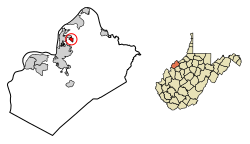 Location of North Hills in Wood County, West Virginia. | |
| Coordinates: 39°18′39″N 81°30′31″W / 39.31083°N 81.50861°WCoordinates: 39°18′39″N 81°30′31″W / 39.31083°N 81.50861°W | |
| Country | United States |
| State | West Virginia |
| County | Wood |
| Incorporated | February 15, 1979 |
| Area | |
| • Total | 0.57 sq mi (1.47 km2) |
| • Land | 0.57 sq mi (1.47 km2) |
| • Water | 0.00 sq mi (0.00 km2) |
| Elevation | 850 ft (259 m) |
| Population | |
| • Total | 832 |
| • Estimate (2019)[3] | 774 |
| • Density | 1,367.49/sq mi (527.63/km2) |
| Time zone | UTC-5 (Eastern (EST)) |
| • Summer (DST) | UTC-4 (EDT) |
| Area code(s) | 304 |
| FIPS code | 54-59458[4] |
| GNIS feature ID | 1560619[5] |
| Website | northhillswv |

North Hills is a town in Wood County, West Virginia, United States. It is an affluent suburb of Parkersburg. The population was 832 at the 2010 census. North Hills was incorporated on February 15, 1979.[6]
Geography[]
North Hills is located at 39°18′39″N 81°30′31″W / 39.31083°N 81.50861°W (39.310719, -81.508479).[7]
According to the United States Census Bureau, the town has a total area of 0.56 square miles (1.45 km2), of which 0.55 square miles (1.42 km2) is land and 0.01 square miles (0.03 km2) is water.[8]
Demographics[]
| Historical population | |||
|---|---|---|---|
| Census | Pop. | %± | |
| 1980 | 940 | — | |
| 1990 | 849 | −9.7% | |
| 2000 | 880 | 3.7% | |
| 2010 | 832 | −5.5% | |
| 2019 (est.) | 774 | [3] | −7.0% |
| U.S. Decennial Census[9] | |||
2010 census[]
At the 2010 census there were 832 people, 295 households, and 250 families living in the town. The population density was 1,512.7 inhabitants per square mile (584.1/km2). There were 308 housing units at an average density of 560.0 per square mile (216.2/km2). The racial makeup of the town was 92.3% White, 2.0% African American, 4.6% Asian, 0.2% from other races, and 0.8% from two or more races. Hispanic or Latino of any race were 1.0%.[2]
Of the 295 households 35.3% had children under the age of 18 living with them, 76.3% were married couples living together, 6.4% had a female householder with no husband present, 2.0% had a male householder with no wife present, and 15.3% were non-families. 11.5% of households were one person and 6.7% were one person aged 65 or older. The average household size was 2.82 and the average family size was 3.07.
The median age in the town was 43.3 years. 26.7% of residents were under the age of 18; 6.1% were between the ages of 18 and 24; 20.7% were from 25 to 44; 32.5% were from 45 to 64; and 14.2% were 65 or older. The gender makeup of the town was 50.8% male and 49.2% female.
2000 census[]
At the 2000 census there were 880 people, 294 households, and 264 families living in the town. The population density was 1,589.1 inhabitants per square mile (617.8/km2). There were 301 housing units at an average density of 543.5 per square mile (211.3/km2). The racial makeup of the town was 92.61% White, 0.57% African American, 0.11% Native American, 5.11% Asian, and 1.59% from two or more races. Hispanic or Latino of any race were 1.59%.[4]
Of the 294 households 44.2% had children under the age of 18 living with them, 85.4% were married couples living together, 3.7% had a female householder with no husband present, and 9.9% were non-families. 8.5% of households were one person and 3.7% were one person aged 65 or older. The average household size was 2.99 and the average family size was 3.16.
The age distribution was 30.3% under the age of 18, 4.2% from 18 to 24, 22.4% from 25 to 44, 33.3% from 45 to 64, and 9.8% 65 or older. The median age was 41 years. For every 100 females there were 97.3 males. For every 100 females age 18 and over, there were 97.7 males.
The median household income was $83,659 and the median family income was $85,768. Males had a median income of $71,944 versus $33,125 for females. The per capita income for the town was $31,862. About 1.8% of families and 2.5% of the population were below the poverty line, including 4.2% of those under age 18 and 3.0% of those age 65 or over.
References[]
- ^ "2019 U.S. Gazetteer Files". United States Census Bureau. Retrieved August 7, 2020.
- ^ a b "U.S. Census website". United States Census Bureau. Retrieved 2013-01-24.
- ^ a b "Population and Housing Unit Estimates". United States Census Bureau. May 24, 2020. Retrieved May 27, 2020.
- ^ a b "U.S. Census website". United States Census Bureau. Retrieved 2008-01-31.
- ^ "US Board on Geographic Names". United States Geological Survey. 2007-10-25. Retrieved 2008-01-31.
- ^ West Virginia Blue Book. Published annually by the Clerk's Office of the West Virginia Senate.
- ^ "US Gazetteer files: 2010, 2000, and 1990". United States Census Bureau. 2011-02-12. Retrieved 2011-04-23.
- ^ "US Gazetteer files 2010". United States Census Bureau. Archived from the original on 2011-02-20. Retrieved 2013-01-24.
- ^ "Census of Population and Housing". Census.gov. Retrieved June 4, 2015.
Municipalities and communities of Wood County, West Virginia, United States | ||
|---|---|---|
| Cities |
|  |
| Town | ||
| CDPs | ||
| Unincorporated communities |
| |
| Ghost towns | ||
| ||
- Populated places established in 1979
- Towns in Wood County, West Virginia