Nyzhnia Rozhanka
Nyzhnia Rozhanka
Нижня Рожанка | |
|---|---|
 Nyzhnia Rozhanka | |
| Coordinates: 48°49′10″N 23°30′23″E / 48.81944°N 23.50639°ECoordinates: 48°49′10″N 23°30′23″E / 48.81944°N 23.50639°E | |
| Country | |
| Province | |
| District | |
| Established | 1675 |
| Area | |
| • Total | 1,883 km2 (727 sq mi) |
| Elevation /(average value of) | 759 m (2,490 ft) |
| Population | |
| • Total | 887 |
| • Density | 4,711/km2 (12,200/sq mi) |
| Time zone | UTC+2 (EET) |
| • Summer (DST) | UTC+3 (EEST) |
| Postal code | 82662 |
| Area code | +380 3251 |
| Website | село Нижня Рожанка(Ukrainian) |
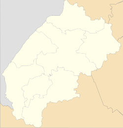
Nyzhnia Rozhanka (Ukrainian: Ни́жня Рожа́нка, Polish: Rożanka Niżna) is a Carpathian village (selo) in Skole Raion, Lviv Oblast, of Western Ukraine. It is located within the limits og the Eastern Beskids (Skole Beskids) in the southern part of the Lviv Oblast. Area of the village totals is 18,83 km2 and the population of the village is about 887 people. Local government is administered by Nyzhnorozhanska village council.[1]
Geography[]
The village is situated along the Rozhanka river,[2] right tributary of the Opir River[3] (Dniester river basin).[4] Distance from the regional center Lviv is 139 kilometres (86 mi) , 31 kilometres (19 mi) from the district center Skole, and 10 kilometres (6.2 mi) from the urban village Slavske.
At a distance 13 kilometres (8.1 mi) are located the ski lifts on the Trostyan mountain.
Mineral springs are located near the villages of Verkhnia Rozhanka and Nyzhnia Rozhanka.[5]
History and Attractions[]
The village is known from the 13th century, although the official founding date of the village is 1675.[6]
The village has a monument of Cultural Heritage in Ukraine, which is the bell tower of the Church of the Epiphany 19th century (wooden) (N – 517).[7]
References[]
- ^ Нижньорожанківська сільська рада (in Ukrainian)
- ^ Рожанка (річка) (in Ukrainian)
- ^ Опір (річка) (in Ukrainian)
- ^ Encyclopædia Britannica, Dniester River
- ^ Article - Львівський національний університет імені Івана Франка Page 4 (in Ukrainian)
- ^ Село Нижня Рожанка: карта вулиць (in Ukrainian)
- ^ Пам'ятки архітектури Сколівського району (in Ukrainian)
External links[]
Literature[]
- Ukrainian: Історія міст і сіл УРСР : Львівська область. – К. : ГРУРЕ, 1968 р. Page 717
| Cities | ||
|---|---|---|
| Settlements | ||
| Villages |
| |
This article about a location in Lviv Oblast is a stub. You can help Wikipedia by . |
- Villages in Skole Raion
- Lviv Oblast geography stubs