Oriava
Oriava
Орява | |
|---|---|
 The general view of village Oriava. | |
 Oriava | |
| Coordinates: 48°55′18″N 23°17′44″E / 48.92167°N 23.29556°ECoordinates: 48°55′18″N 23°17′44″E / 48.92167°N 23.29556°E | |
| Country | |
| Province | |
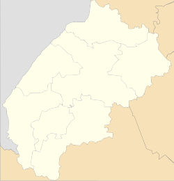
| District | |
| Established | 1574 |
| Area | |
| • Total | 33 km2 (13 sq mi) |
| Elevation /(average value of) | 671 m (2,201 ft) |
| Population | |
| • Total | 523 |
| • Density | 19,182/km2 (49,680/sq mi) |
| Time zone | UTC+2 (EET) |
| • Summer (DST) | UTC+3 (EEST) |
| Postal code | 82640 |
| Area code | +380 3251 |
| Website | село Орява (Ukrainian) |

Oriava (Ukrainian: Оря́ва[1], Polish: Orawa) is a village (selo) in Skole Raion, Lviv Oblast, of Western Ukraine. Village Oriava is located in the Ukrainian Carpathians, within the limits of the Eastern Beskids ( Skole Beskids ) in southern Lviv Oblast. The village is located along the river with the same name Oriava.[2]
It is 133 kilometres (83 mi) from the city of Lviv, 61 kilometres (38 mi) from Stryi, and 24 kilometres (15 mi) from Skole.
Local government– Oriavska village council.[3]
The first mention of Oriava dates from the year 1574.[4]
Attractions[]

Church of the Nativity Blessed Virgin Mary (wood) 1882
The village has an architectural monument of local importance of Skole Raion (Skole district).[5]
- Church of the Nativity Blessed Virgin Mary (wood) 1882 (the previous name - Church of St. Arch. Michael).
References[]
- ^ Оря́ва, вікіпедія (in Ukrainian)
- ^ Oriava (in Ukrainian)
- ^ Орявська сільська рада (in Ukrainian)
- ^ [1] (in Ukrainian)
- ^ Пам'ятки архітектури Сколівського району (in Ukrainian)
External links[]
- Населенні пункти Сколівського району - Орява (in Ukrainian)
- Сколівщина.-Львів.1996 (in Ukrainian)
- weather.in.ua
| Cities | ||
|---|---|---|
| Settlements | ||
| Villages |
| |
This article about a location in Lviv Oblast is a stub. You can help Wikipedia by . |
Categories:
- Villages in Skole Raion
- Lviv Oblast geography stubs