Oak Grove Heights, Arkansas
Oak Grove Heights, Arkansas | |
|---|---|
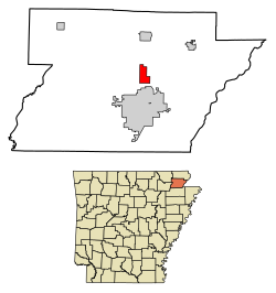 Location of Oak Grove Heights in Greene County, Arkansas. | |
| Coordinates: 36°7′39″N 90°30′55″W / 36.12750°N 90.51528°WCoordinates: 36°7′39″N 90°30′55″W / 36.12750°N 90.51528°W | |
| Country | United States |
| State | Arkansas |
| County | Greene |
| Area | |
| • Total | 3.00 sq mi (7.77 km2) |
| • Land | 3.00 sq mi (7.76 km2) |
| • Water | 0.01 sq mi (0.02 km2) |
| Elevation | 335 ft (102 m) |
| Population (2020) | |
| • Total | 1,104 |
| • Density | 368.61/sq mi (142.34/km2) |
| Time zone | UTC-6 (Central (CST)) |
| • Summer (DST) | UTC-5 (CDT) |
| FIPS code | 05-51060 |
| GNIS feature ID | 0064855 |
| Website | www |

Oak Grove Heights is a city[2] in Greene County, Arkansas, United States. The population was 889 at the 2010 census.
Geography[]
Oak Grove Heights is located at 36°7′39″N 90°30′55″W / 36.12750°N 90.51528°W (36.127406, -90.515286).[3]
According to the United States Census Bureau, the town has a total area of 7.9 km2 (3.0 mi2), of which 7.9 km2 (3.0 mi2) is land and 0.33% is water.
Demographics[]
| Historical population | |||
|---|---|---|---|
| Census | Pop. | %± | |
| 1980 | 486 | — | |
| 1990 | 513 | 5.6% | |
| 2000 | 727 | 41.7% | |
| 2010 | 889 | 22.3% | |
| 2020 | 1,104 | 24.2% | |
| U.S. Decennial Census[4] | |||
As of the 2010 United States Census, there were 889 people living in the town. The racial makeup of the town was 97.4% White, 1.0% Black, 0.1% Native American and 0.2% Asian. 1.2% were Hispanic or Latino of any race.
As of the census[5] of 2000, there were 727 people, 264 households, and 218 families living in the town. The population density was 92.3/km2 (239.0/mi2). There were 282 housing units at an average density of 35.8/km2 (92.7/mi2). The racial makeup of the town was 99.04% White, and 0.96% from two or more races.
There were 264 households, out of which 37.5% had children under the age of 18 living with them, 71.6% were married couples living together, 6.8% had a female householder with no husband present, and 17.4% were non-families. 15.9% of all households were made up of individuals, and 5.7% had someone living alone who was 65 years of age or older. The average household size was 2.75 and the average family size was 3.07.
In the town, the population was spread out, with 27.2% under the age of 18, 11.4% from 18 to 24, 28.2% from 25 to 44, 24.8% from 45 to 64, and 8.4% who were 65 years of age or older. The median age was 33 years. For every 100 females, there were 102.5 males. For every 100 females age 18 and over, there were 98.1 males.
The median income for a household in the town was $31,979, and the median income for a family was $37,083. Males had a median income of $25,333 versus $18,000 for females. The per capita income for the town was $12,603. About 7.9% of families and 9.8% of the population were below the poverty line, including 7.1% of those under age 18 and 19.2% of those age 65 or over.
Education[]
It is in the Paragould School District.[6]
References[]
- ^ "2020 U.S. Gazetteer Files". United States Census Bureau. Retrieved October 29, 2021.
- ^ Local.Arkansas.gov - Oak Grove Heights, retrieved September 3, 2012
- ^ "US Gazetteer files: 2010, 2000, and 1990". United States Census Bureau. 2011-02-12. Retrieved 2011-04-23.
- ^ "Census of Population and Housing". Census.gov. Retrieved June 4, 2015.
- ^ "U.S. Census website". United States Census Bureau. Retrieved 2008-01-31.
- ^ "SCHOOL DISTRICT REFERENCE MAP (2010 CENSUS): Greene County, AR" (PDF). U.S. Census Bureau. Retrieved 2021-03-05.
Municipalities and communities of Greene County, Arkansas, United States | ||
|---|---|---|
| Cities |  | |
| Towns | ||
| CDP | ||
| Other unincorporated communities | ||
| ||
- Towns in Greene County, Arkansas
- Towns in Arkansas