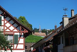
Oberstammheim
Oberstammheim | |
|---|---|
 | |
 Coat of arms | |
show Location of Oberstammheim | |
 Oberstammheim | |
| Coordinates: 47°38′N 8°48′E / 47.633°N 8.800°ECoordinates: 47°38′N 8°48′E / 47.633°N 8.800°E | |
| Country | Switzerland |
| Canton | Zurich |
| District | Andelfingen |
| Area | |
| • Total | 9.36 km2 (3.61 sq mi) |
| Elevation | 440 m (1,440 ft) |
| Population (2018-12-31)[2] | |
| • Total | 1,164 |
| • Density | 120/km2 (320/sq mi) |
| Time zone | UTC+01:00 (Central European Time) |
| • Summer (DST) | UTC+02:00 (Central European Summer Time) |
| Postal code(s) | 8477 |
| SFOS number | 0036 |
| Surrounded by | Hüttwilen (TG), Neunforn (TG), Unterstammheim, Wagenhausen (TG), Waltalingen |
| Website | www SFSO statistics |


Oberstammheim is a former municipality in the district of Andelfingen in the canton of Zurich in Switzerland.
History[]
In 2009, archaeologists announced the discovery of an Iron Age (late Hallstatt or early La Tène) tumulus burial, apparently of a Celtic nobleman. While there are comparable finds in Germany, the site is unique in Switzerland.[3]
Oberstammheim is first mentioned in 761 as Stamhaim. In 1212 it was mentioned as in Stamehein superiori.[4]
On 1 January 2019 the former municipalities of Oberstammheim, Unterstammheim and Waltalingen merged into the new municipality of Stammheim.

Geography[]
Oberstammheim has an area of 9.4 km2 (3.6 sq mi). Of this area, 54.9% is used for agricultural purposes, while 36.7% is forested. Of the rest of the land, 8.2% is settled (buildings or roads) and the remainder (0.2%) is non-productive (rivers, glaciers or mountains).[5]
The municipality is located in the Züricher Weinland on the border with the canton of Thurgau on the southern slope of the Stammerberg. It includes the village of Oberstammheim and the Zürich part of the hamlet of Wilen bei Neunforn. For a short time (1853–86) Wilen bei Neunforn, together with the Thurgau section of the hamlet, was an independent municipality.
Demographics[]

Oberstammheim has a population (as of 31 December 2019) of 1,164.[6] As of 2007, 5.7% of the population was made up of foreign nationals. Over the last 10 years the population has grown at a rate of 2.4%. Most of the population (as of 2000) speaks German (97.2%), with French being second most common ( 0.7%) and Italian being third ( 0.7%).
In the 2007 election the most popular party was the SVP which received 41.1% of the vote. The next three most popular parties were the FDP (16.2%), the SPS (14%) and the Green Party (10.9%).
The age distribution of the population (as of 2000) is children and teenagers (0–19 years old) make up 28.6% of the population, while adults (20–64 years old) make up 53.5% and seniors (over 64 years old) make up 18%. In Oberstammheim about 85% of the population (between age 25-64) have completed either non-mandatory upper secondary education or additional higher education (either university or a Fachhochschule).
Oberstammheim has an unemployment rate of 0.68%. As of 2005, there were 93 people employed in the primary economic sector and about 34 businesses involved in this sector. 56 people are employed in the secondary sector and there are 13 businesses in this sector. 213 people are employed in the tertiary sector, with 34 businesses in this sector.[5] The historical population is given in the following table:[4]
| year | population |
|---|---|
| 1467 | 44 Households |
| 1637 | 359 |
| 1663 | 577 |
| 1695 | 529 |
| 1746 | 587 |
| 1850 | 989 |
| 1900 | 818 |
| 1950 | 758 |
| 2000 | 1,064 |
Transport[]
Stammheim railway station, situated in the neighbouring municipality of Unterstammheim, is served by Zurich S-Bahn line S29, which links Winterthur and Stein am Rhein.[7][8]
References[]
- ^ Jump up to: a b "Arealstatistik Standard - Gemeinden nach 4 Hauptbereichen". Federal Statistical Office. Retrieved 13 January 2019.
- ^ "Ständige Wohnbevölkerung nach Staatsangehörigkeitskategorie Geschlecht und Gemeinde; Provisorische Jahresergebnisse; 2018". Federal Statistical Office. 9 April 2019. Retrieved 11 April 2019.
- ^ Fürstengrab in Oberstammheim gefunden NZZ 21 August 2009.
- ^ Jump up to: a b Oberstammheim in German, French and Italian in the online Historical Dictionary of Switzerland.
- ^ Jump up to: a b Swiss Federal Statistical Office accessed 28-Jul-2009
- ^ "Ständige und nichtständige Wohnbevölkerung nach institutionellen Gliederungen, Geburtsort und Staatsangehörigkeit". bfs.admin.ch (in German). Swiss Federal Statistical Office - STAT-TAB. 31 December 2019. Retrieved 6 October 2020.
- ^ map.geo.admin.ch (Map). Swiss Confederation. Retrieved 2012-02-28.
- ^ "S-Bahn trains, buses and boats" (PDF). ZVV. Archived from the original (PDF) on January 31, 2012. Retrieved 2012-02-28.
External links[]
| Wikimedia Commons has media related to Oberstammheim. |
- Official website (in German)
| show Authority control |
|---|
- Former municipalities of the canton of Zürich