Oberweißbach
show This article may be expanded with text translated from the corresponding article in German. (August 2012) Click [show] for important translation instructions. |
Oberweißbach | |
|---|---|
Ortsteil of Schwarzatal | |
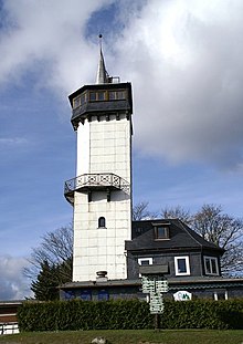
 Friedrich Fröbel's birthplace in Oberweißbach | |
 Coat of arms | |
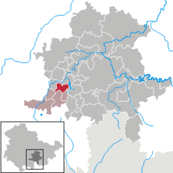
show Location of Oberweißbach within Schwarzatal | |
 Oberweißbach | |
| Coordinates: 50°34′58″N 11°8′40″E / 50.58278°N 11.14444°ECoordinates: 50°34′58″N 11°8′40″E / 50.58278°N 11.14444°E | |
| Country | Germany |
| State | Thuringia |
| District | Saalfeld-Rudolstadt |
| Municipal assoc. | Bergbahnregion/Schwarzatal |
| Town | Schwarzatal |
| Area | |
| • Total | 9.62 km2 (3.71 sq mi) |
| Elevation | 670 m (2,200 ft) |
| Population (2017-12-31) | |
| • Total | 1,678 |
| • Density | 170/km2 (450/sq mi) |
| Time zone | UTC+01:00 (CET) |
| • Summer (DST) | UTC+02:00 (CEST) |
| Postal codes | 98744 |
| Dialling codes | 036705 |
| Vehicle registration | SLF |
| Website | Official website |


Oberweißbach (or Oberweissbach, German: [oː.bɐ.ˈvaɪ̯s.bax] (![]() listen)) is a town and a former municipality in the district of Saalfeld-Rudolstadt, in Thuringia, Germany. Since 1 January 2019, it is part of the town Schwarzatal.
listen)) is a town and a former municipality in the district of Saalfeld-Rudolstadt, in Thuringia, Germany. Since 1 January 2019, it is part of the town Schwarzatal.

Overview[]
Oberweißbach is situated in the Thuringian Forest, 17 km (11 mi) southwest of Saalfeld. On 1 December 2008, it incorporated the former municipality Lichtenhain/Bergbahn.
Geography[]
Oberweißbach is a nationally recognized resort town in the Thuringian Forest Nature Park in the Weißbachtal.
It was the seat of the former municipal administration Bergbahnregion/Schwarzatal with communities of Cursdorf, Deesbach, Katzhütte, Oberweißbach and Meuselbach-Schwarzmühle. Colloquially this area is called , based on the primary transportation method of the pharmacists, the backpack. These pharmacists shaped this region between the 16th and 20th centuries.
The town of Oberweißbach consists of two districts:
- Oberweißbach / Thüringer Wald and
- Lichtenhain/Bergbahn.
References[]
External links[]
![]() Media related to Oberweißbach at Wikimedia Commons
Media related to Oberweißbach at Wikimedia Commons
| show Authority control |
|---|
This Saalfeld-Rudolstadt location article is a stub. You can help Wikipedia by . |
- Saalfeld-Rudolstadt
- Schwarzburg-Rudolstadt
- Bezirk Suhl
- Former municipalities in Thuringia
- Thuringia geography stubs