Schwarzatal
Schwarzatal | |
|---|---|
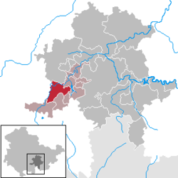
show Location of Schwarzatal within Saalfeld-Rudolstadt district | |
 Schwarzatal | |
| Coordinates: 50°35′N 11°09′E / 50.583°N 11.150°ECoordinates: 50°35′N 11°09′E / 50.583°N 11.150°E | |
| Country | Germany |
| State | Thuringia |
| District | Saalfeld-Rudolstadt |
| Municipal assoc. | Schwarzatal |
| Subdivisions | 9 |
| Area | |
| • Total | 25.99 km2 (10.03 sq mi) |
| Elevation | 670 m (2,200 ft) |
| Population (2020-12-31)[1] | |
| • Total | 3,504 |
| • Density | 130/km2 (350/sq mi) |
| Time zone | UTC+01:00 (CET) |
| • Summer (DST) | UTC+02:00 (CEST) |
| Postal codes | 98744, 98746 |
| Dialling codes | 036705 |
| Vehicle registration | SLF |


Schwarzatal is a town and a municipality in the district Saalfeld-Rudolstadt, in Thuringia, Germany. It was created with effect from 1 January 2019 by the merger of the former municipalities of Mellenbach-Glasbach, Meuselbach-Schwarzmühle and Oberweißbach. The name refers to the river Schwarza.
References[]
| show Towns and municipalities in Saalfeld-Rudolstadt |
|---|
| Authority control |
|---|
This Saalfeld-Rudolstadt location article is a stub. You can help Wikipedia by . |
Categories:
- Towns in Thuringia
- Saalfeld-Rudolstadt
- Thuringia geography stubs