Olginate
Olginate | |
|---|---|
| Comune di Olginate | |
 | |
show Location of Olginate | |
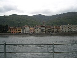
 Olginate Location of Olginate in Italy | |
| Coordinates: 45°48′0″N 9°25′0″E / 45.80000°N 9.41667°ECoordinates: 45°48′0″N 9°25′0″E / 45.80000°N 9.41667°E | |
| Country | Italy |
| Region | Lombardy |
| Province | Province of Lecco (LC) |
| Frazioni | Capiate, Consonno |
| Government | |
| • Mayor | Rocco Briganti (Civic list) |
| Area | |
| • Total | 7.9 km2 (3.1 sq mi) |
| Elevation | 200 m (700 ft) |
| Population (Oct. 2010)[2] | |
| • Total | 7,200 |
| • Density | 910/km2 (2,400/sq mi) |
| Demonym(s) | Olginatesi |
| Time zone | UTC+1 (CET) |
| • Summer (DST) | UTC+2 (CEST) |
| Postal code | 23854 |
| Dialing code | 0341 |
| Patron saint | Saint Agnes |
| Saint day | 21 January |
| Website | Official website |


Olginate (Brianzöö: Ulginàa) is a comune (municipality) in the Province of Lecco in the Italian region Lombardy, located about 40 kilometres (25 mi) northeast of Milan and about 6 kilometres (4 mi) south of Lecco. As of October 2010, it had a population of 7,200 and an area of 7.9 square kilometres (3.1 sq mi).[3]
The municipality of Olginate contains the frazione (subdivision) Consonno.
Olginate borders the following municipalities: Airuno, Brivio, Calolziocorte, Galbiate, Garlate, Valgreghentino, Vercurago.
It is served by Calolziocorte-Olginate railway station.
Demographic evolution[]

References[]
- ^ "Superficie di Comuni Province e Regioni italiane al 9 ottobre 2011". Istat. Retrieved 16 March 2019.
- ^ "Popolazione Residente al 1° Gennaio 2018". Istat. Retrieved 16 March 2019.
- ^ All demographics and other statistics: Italian statistical institute ISTAT.
External links[]
| Authority control |
|
|---|
This article on a location in the Province of Lecco is a stub. You can help Wikipedia by . |
Categories:
- Cities and towns in Lombardy
- Municipalities of the Province of Lecco
- Province of Lecco geography stubs