Ordu-Baliq
This article needs additional citations for verification. (June 2011) |
 The west gate as seen from the citadel | |
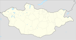 Location of Ordu Baliq in Mongolia | |
| Location | Mongolia |
|---|---|
| Coordinates | 47°25′52″N 102°39′34″E / 47.431111°N 102.659444°E |

Ordu-Baliq[dn 1] (meaning "city of the court", "city of the army"; Chinese: 窩魯朵八里), also known as Mubalik and Karabalghasun, was the capital of the first Uyghur Khaganate. It was built on the site of the former Göktürk imperial capital, 27 km north-to-northwest of the later Mongol capital, Karakorum. Its ruins are known as Kharbalgas in Mongolian, which means "black city". They form part of the Orkhon Valley Cultural Landscape World Heritage Site.
Location[]
Ordu-Baliq is in a grassy plain called the Talal-khain-dala steppe, on the western bank of the Orkhon River in the Khotont sum of the Arkhangai Province, Mongolia, 16 km northeast of the Khotont village, or 30 km north-to-northwest of Kharkhorin. The Orkhon emerges from the gorges of the Khangai Mountains and flows northward to meet the Tuul River, which has on its upper reaches the current capital of Mongolia, Ulan Bator.
A favorable micro-climate makes the location ideal for pasturage, and it lies along the most important east-west route across Mongolia. As a result, the Orkhon Valley was a center of habitation and important political and economic activity long before the birth of Genghis Khan, who made it known to the wider world.
History[]

In 744, after the defeat of the last Göktürk Kaghan by the Uyghur-Qarluk-Basmyl alliance, the Uyghurs under Bayanchur Khan (Bayan Çor) established their imperial capital Ordu Baliq on the site of the old ördü ("nomadic capital"). Ordu-Baliq flourished until 840, when it was reduced to ruin by the invading Yenisey Kyrgyzes.
The capital occupied at least 32 square kilometers.[1] The ruins of the palace or temple complex laying at coordinates 47°25′53″N 102°39′34″E / 47.431288°N 102.659349°E — which include ten-meter-high double clay walls four meters apart, 14 watch towers -- eight on the southern side and six on the northern side -- two main entrances, one on the east and the other on the west, a twelve-meter-high citadel in the southeast corner and a 14-meter-high stupa in the center — clearly indicate that Ordu Baliq or Urgin Balyq Old Turkic: