Orne (river)
| Orne | |
|---|---|
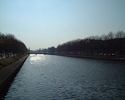 The Orne in Caen | |
| Location | |
| Country | France |
| Physical characteristics | |
| Source | |
| • location | Aunou-sur-Orne |
| • elevation | 240 m (790 ft) |
| Mouth | |
• location | English Channel |
• coordinates | 49°16′42″N 0°13′34″W / 49.27833°N 0.22611°WCoordinates: 49°16′42″N 0°13′34″W / 49.27833°N 0.22611°W |
| Length | 170 km (110 mi) |
| Basin size | 2,932 km2 (1,132 sq mi) |
| Discharge | |
| • average | 27.5 m3/s (970 cu ft/s) |

The Orne (French: [ɔʁn] (![]() listen)) is a river in Normandy, within northwestern France. It is 170 km (110 mi) long.[1] It discharges into the English Channel at the port of Ouistreham. Its source is in Aunou-sur-Orne, east of Sées. Its main tributaries are the Odon and the Rouvre.
listen)) is a river in Normandy, within northwestern France. It is 170 km (110 mi) long.[1] It discharges into the English Channel at the port of Ouistreham. Its source is in Aunou-sur-Orne, east of Sées. Its main tributaries are the Odon and the Rouvre.
The Orne flows through the following departments and towns:
- Orne (named after the river): Sées, Argentan
- Calvados: Thury-Harcourt, Caen, Ouistreham
Name[]
The name of the Orne in Normandy, which is referred to as the Olinas by Ptolemy,[2] is a homonym of Fluvius Olne, the Orne saosnoise in Sarthe, which Xavier Delamarre traces back to the Celtic olīnā (elbow).
Hydrology and water quality[]
The waters of the Orne are typically moderately turbid and brown in colour. pH levels of the Orne have been measured at 8.5[3] at the town of St. Andre sur Orne where summer water temperatures approximate 18 degrees Celsius. Electrical conductivity of the Orne has been measured at 30 micro-Siemens per centimeter.
See also[]
- St. Andre sur Orne
- Canal de Caen à la Mer
References[]
- ^ Sandre. "Fiche cours d'eau - L'Orne (I2--0200)".
- ^
 Smith, William, ed. (1857). "Olinas". Dictionary of Greek and Roman Geography. 2. London: John Murray. p. 473–474.
- ^ Hogan, C Michael, Water quality of freshwater bodies in France, Lumina Press, Aberdeen 2006
| Wikimedia Commons has media related to Orne River. |
| hide Authority control | |
|---|---|
| General | |
| National libraries | |
| Other |
|
This Normandy geography article is a stub. You can help Wikipedia by . |
- Rivers of Normandy
- Rivers of France
- Rivers of Calvados (department)
- Rivers of Orne
- Coastal basins of the English Channel in France
- Normandy geography stubs
- France river stubs