Ouahigouya
This article needs additional citations for verification. (June 2014) |
Ouahigouya | |
|---|---|
 | |
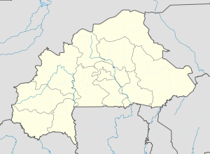 Ouahigouya Location within Burkina Faso, French West Africa | |
| Coordinates: 13°35′N 2°25′W / 13.583°N 2.417°W | |
| Country | |
| Province | Nord Region |
| Province | Yatenga Province |
| Founded | 1757 |
| Elevation | 315 m (1,033 ft) |
| Population (2019 census)[1] | |
| • Total | 124,580 |
| Time zone | UTC+0 (GMT) |

Ouahigouya is a town in northern Burkina Faso. It is the capital of the Yatenga Province and one of its subdivisions the Ouahigouya Department. It is also the biggest town in the Nord Region. It is the fourth largest city in the country with a population of 124,580 (2019)[1] and is situated 182 kilometres (113 mi) north-west of Ouagadougou.

The city itself has a stadium, a private non-profit Paediatric Hospital with 36 beds for giving birth and 24 beds for children suffering of severe malnutrition, a post office with internet access and at least one Ecobank bank branch.
History[]
The city was founded in 1757 as the capital of Yatenga one of a number of Mossi Kingdoms. The city still bears testimony to its role as capital of the Yatenga Kingdom in its name, the meaning of which is come and prostrate yourselves.
In the Christmas War of 1985, the city's marketplace was bombed by Malian forces, almost 100 people being killed.
Economy[]
Mainly of an agriculturally based economy, Ouahigouya also has some commerce and craft industry. The two dams just north and west of the town permit it to pursue some vegetable planting aided by irrigation, such as tomatoes, carrots, onions and mainly potatoes. But as a whole both the region and the city are heavily dependent on rainfall and it is according to it that the population's well-being mostly depends on. Millet and sorghum though are the basis of the local diet, much like the surrounding regions.
The small craft industry here is mainly focused on leather and tanneries. The little industry in the region is mostly geared towards gold prospecting, and is carried out by a large company. In terms of commerce, the city takes advantage of its relative ease of access to the country's capital, Ouagadougou, to buy manufactured products and resell to the local economy. This is greatly facilitated by the asphalted road linking the two cities.
Places of interest[]
Features of Ouahigouya include Naaba Kango's tomb, the 's compound and an artificial lake.
Geography[]
Climate[]
Classified by Köppen-Geiger system as hot semi-arid (BSh).
| hideClimate data for Ouahigouya (1971–2000, extremes 1920–present) | |||||||||||||
|---|---|---|---|---|---|---|---|---|---|---|---|---|---|
| Month | Jan | Feb | Mar | Apr | May | Jun | Jul | Aug | Sep | Oct | Nov | Dec | Year |
| Record high °C (°F) | 40.0 (104.0) |
42.5 (108.5) |
44.2 (111.6) |
45.5 (113.9) |
48.8 (119.8) |
48.0 (118.4) |
40.8 (105.4) |
38.6 (101.5) |
41.3 (106.3) |
41.8 (107.2) |
40.6 (105.1) |
43.6 (110.5) |
48.8 (119.8) |
| Average high °C (°F) | 32.2 (90.0) |
35.3 (95.5) |
38.3 (100.9) |
40.5 (104.9) |
39.8 (103.6) |
37.0 (98.6) |
33.8 (92.8) |
32.4 (90.3) |
33.9 (93.0) |
37.2 (99.0) |
36.2 (97.2) |
32.9 (91.2) |
35.8 (96.4) |
| Average low °C (°F) | 16.8 (62.2) |
19.2 (66.6) |
23.2 (73.8) |
26.5 (79.7) |
27.3 (81.1) |
25.5 (77.9) |
23.6 (74.5) |
22.9 (73.2) |
23.1 (73.6) |
23.4 (74.1) |
20.1 (68.2) |
17.4 (63.3) |
22.4 (72.3) |
| Record low °C (°F) | 8.5 (47.3) |
11.2 (52.2) |
13.1 (55.6) |
13.5 (56.3) |
17.0 (62.6) |
15.7 (60.3) |
17.9 (64.2) |
18.6 (65.5) |
18.1 (64.6) |
16.2 (61.2) |
11.2 (52.2) |
10.0 (50.0) |
8.5 (47.3) |
| Average rainfall mm (inches) | 0.1 (0.00) |
0.0 (0.0) |
1.4 (0.06) |
8.8 (0.35) |
33.4 (1.31) |
78.7 (3.10) |
153.0 (6.02) |
183.4 (7.22) |
103.8 (4.09) |
27.0 (1.06) |
1.1 (0.04) |
0.1 (0.00) |
590.8 (23.26) |
| Average rainy days (≥ 0.1 mm) | 0 | 0 | 0 | 2 | 5 | 8 | 12 | 15 | 10 | 4 | 0 | 0 | 56 |
| Average relative humidity (%) | 26 | 22 | 26 | 35 | 52 | 64 | 73 | 80 | 77 | 62 | 40 | 29 | 49 |
| Mean monthly sunshine hours | 291 | 267 | 280 | 268 | 284 | 272 | 258 | 253 | 261 | 280 | 288 | 280 | 3,282 |
| Source 1: World Meteorological Organization,[2] Meteo Climat (record highs and lows)[3] | |||||||||||||
| Source 2: Deutscher Wetterdienst (humidity, 1951–1967, and sun, 1961–1990)[4][5][a] | |||||||||||||
Sister Cities[]
Ouahigouya has one sister city:[6]
See also[]
Notes[]
- ^ Station ID for Ouahigouya is 65502 Use this station ID to locate the sunshine duration
References[]
- ^ Jump up to: a b Citypopulation.de Population of the major cities in Burkina Faso
- ^ "World Weather Information Service – Ouahigouya". World Meteorological Organization. Retrieved 13 June 2016.
- ^ "Station Ouahigouya" (in French). Meteo Climat. Retrieved 13 June 2016.
- ^ "Klimatafel von Ouahigouya / Burkina Faso (Obervolta)" (PDF). Baseline climate means (1961-1990) from stations all over the world (in German). Deutscher Wetterdienst. Retrieved 13 June 2016.
- ^ "Station 65502: Ouahigouya". Global station data 1961–1990—Sunshine Duration. Deutscher Wetterdienst. Archived from the original on 17 October 2017. Retrieved 13 June 2016.
- ^ http://www.sistercities.org/sites/default/files/SCI%20MEMBER%20DIRECTORY%202012.pdf
External links[]
 Ouahigouya travel guide from Wikivoyage
Coordinates: 13°35′N 2°25′W / 13.583°N 2.417°W
| show Authority control |
|---|
- Populated places in the Nord Region (Burkina Faso)
- Populated places established in 1757
- Yatenga Province