Oupoyo
Oupoyo | |
|---|---|
Town and sub-prefecture | |
 Oupoyo Location in Ivory Coast | |
| Coordinates: 5°34′N 6°36′W / 5.567°N 6.600°WCoordinates: 5°34′N 6°36′W / 5.567°N 6.600°W | |
| Country | |
| District | Bas-Sassandra |
| Region | Nawa |
| Department | Méagui |
| Population (2014)[1] | |
| • Total | 72,206 |
| Time zone | UTC+0 (GMT) |

Oupoyo is a town in southwestern Ivory Coast. It is a sub-prefecture of Méagui Department in Nawa Region, Bas-Sassandra District.
The far western portion of the sub-prefecture is located in Taï National Park.
Oupoyo was a commune until March 2012, when it became one of 1126 communes nationwide that were abolished.[2]
In 2014, the population of the sub-prefecture of Oupoyo was 72,206.[3]
Villages[]
The fifteen villages of the sub-prefecture of Oupoyo and their population in 2014 are:[3]
- Dahili (5 076 )
- Gblétia (8 595 )
- Gnakoragui (1 760 )
- Gnipi 2 (5 769 )
- Guéagui (1 086 )
- Guiré (1 225 )
- Ipouagui (7 788 )
- Koréagui (1 880 )
- Koréagui 2 (3 409 )
- N'driagui (3 253 )
- Oupagui (3 251 )
- Oupoyo (18 386 )
- Petit-Bondoukou (3 772 )
- Robert-Porte (3 418 )
- Sérigbangan (4 538 )
References[]
- ^ "Côte d'Ivoire". geohive.com. Retrieved 7 December 2015.
- ^ "Le gouvernement ivoirien supprime 1126 communes, et maintient 197 pour renforcer sa politique de décentralisation en cours", news.abidjan.net, 7 March 2012.
- ^ a b "RGPH 2014, Répertoire des localités, Région Nawa" (PDF). ins.ci. Retrieved 5 August 2019.
Regional seat: Soubré | ||
| Buyo Department | 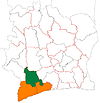 | |
| Guéyo Department | ||
| Méagui Department | ||
| Soubré Department | ||
* also a commune; Mayo in Soubré Department is a commune but not a sub-prefecture | ||
This Bas-Sassandra District location article is a stub. You can help Wikipedia by . |
Categories:
- Sub-prefectures of Nawa Region
- Former communes of Ivory Coast
- Bas-Sassandra District geography stubs