Soubré
Soubré | |
|---|---|
City, sub-prefecture, and commune | |
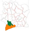
 Soubré Location in Ivory Coast | |
| Coordinates: 5°47′N 6°36′W / 5.783°N 6.600°WCoordinates: 5°47′N 6°36′W / 5.783°N 6.600°W | |
| Country | |
| District | Bas-Sassandra |
| Region | Nawa |
| Department | Soubré |
| Population (2014)[1] | |
| • Total | 175,163 |
| Time zone | UTC+0 (GMT) |

Soubré is a city in southwestern Ivory Coast. It is a sub-prefecture of and the seat of Soubré Department. It is also a commune and the seat of Nawa Region in Bas-Sassandra District. In the 2014 census, Soubré's population was 175,163.[1] In 2014, the population of the sub-prefecture of Soubré was 175,163.[2]
Villages[]
The twenty two villages of the sub-prefecture of Soubré and their population in 2014 are:[2]
- Galéa 1 (1 313)
- Galéa 2 (3 454)
- Gbaléyo (1 935 )
- Gripazo (2 234 )
- Guéyo (242 )
- Kopéragui (1 982 )
- Kpéhiri (2 432 )
- Logboayo (2 098 )
- Mahio (1 618 )
- Soubouo (2 752 )
- Soubre (101 196 )
- Badayo (1 571 )
- Djoutougbo (3 288 )
- Kiodja-Tchad (3 052 )
- Konédougou (10 302 )
- Koréyo (1 137 )
- Niapoyo (1 862 )
- Obrouayo (8 055 )
- Sayo (1 626 )
- Tapéyo (793 )
- Yabayo (20 086 )
- Zergbeu (2 135 )
Climate[]
Köppen-Geiger climate classification system classifies its climate as tropical wet and dry (Aw).[3]
| hideClimate data for Soubré | |||||||||||||
|---|---|---|---|---|---|---|---|---|---|---|---|---|---|
| Month | Jan | Feb | Mar | Apr | May | Jun | Jul | Aug | Sep | Oct | Nov | Dec | Year |
| Average high °C (°F) | 31.7 (89.1) |
32.4 (90.3) |
32.2 (90.0) |
32 (90) |
31.1 (88.0) |
29.3 (84.7) |
28.1 (82.6) |
27.7 (81.9) |
28.6 (83.5) |
29.9 (85.8) |
30.5 (86.9) |
30.6 (87.1) |
30.3 (86.7) |
| Daily mean °C (°F) | 26.4 (79.5) |
27.2 (81.0) |
27.1 (80.8) |
27.1 (80.8) |
26.6 (79.9) |
25.6 (78.1) |
24.7 (76.5) |
24.4 (75.9) |
25 (77) |
25.8 (78.4) |
26.1 (79.0) |
26 (79) |
26.0 (78.8) |
| Average low °C (°F) | 21.1 (70.0) |
22 (72) |
22.1 (71.8) |
22.3 (72.1) |
22.2 (72.0) |
22 (72) |
21.3 (70.3) |
21.2 (70.2) |
21.5 (70.7) |
21.8 (71.2) |
21.8 (71.2) |
21.4 (70.5) |
21.7 (71.2) |
| Average precipitation mm (inches) | 29 (1.1) |
65 (2.6) |
128 (5.0) |
146 (5.7) |
172 (6.8) |
223 (8.8) |
112 (4.4) |
98 (3.9) |
198 (7.8) |
167 (6.6) |
111 (4.4) |
54 (2.1) |
1,503 (59.2) |
| Source: Climate-Data.org (altitude: 144m)[3] | |||||||||||||
References[]
- ^ Jump up to: a b "Côte d'Ivoire". geohive.com. Retrieved 5 December 2015.
- ^ Jump up to: a b "RGPH 2014, Répertoire des localités, Région Nawa" (PDF). ins.ci. Retrieved 5 August 2019.
- ^ Jump up to: a b "Climate: Soubré - Climate graph, Temperature graph, Climate table". Climate-Data.org. Retrieved 1 December 2013.
| Authority control |
|
|---|
This Bas-Sassandra District location article is a stub. You can help Wikipedia by . |
Categories:
- Sub-prefectures of Nawa Region
- Communes of Nawa Region
- Regional capitals of Ivory Coast
- Bas-Sassandra District geography stubs