Ouzoum
| Ouzoum | |
|---|---|
 | |
 | |
| Location | |
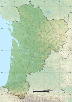
| Country | France |
| Physical characteristics | |
| Source | |
| • location | |
| • coordinates | 42°57′42″N 0°17′23″W / 42.96167°N 0.28972°W |
| • elevation | 1,131 m (3,711 ft) |
| Mouth | |
• location | Gave de Pau |
• coordinates | 43°10′14″N 0°14′50″W / 43.17056°N 0.24722°WCoordinates: 43°10′14″N 0°14′50″W / 43.17056°N 0.24722°W |
| Length | 33 km (21 mi) |
| Basin size | 163 km2 (63 sq mi) |
| Discharge | |
| • average | 6.85 m3/s (242 cu ft/s) |
| Basin features | |
| Progression | Gave de Pau→ Gaves réunis→ Adour→ Atlantic Ocean |

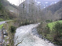
The Ouzoum or Ouzom (/ uzũ /) is a left tributary of the Gave de Pau, in the Southwest of France, between the and the Béez. It is 33.3 km (20.7 mi) long.[1]
It flows into the Gave in Nay, upstream from Pau.
Name[]
Historical graphies were oscillating between the voiced -s- and the unvoiced -ss-: Oson (1441), Osom, Osson, Ozon (1538), le Lozon (1581), l'Ouson (1585).[2][3]
This name could be related with the Pyrenean hydronym Ousse.[4]
Geography[]
The valley of the Ouzoum is separated in two distinct parts by a 9-kilometre (6 mi) long narrow pass. The villages in the upper part of the valley (Arbéost and Ferrières) belong to the Hautes-Pyrénées and have relationships with the , on the other side of the mountain. On the other hand, the lower part of the valley, close to Pau, is Béarnese (Pyrénées-Atlantiques).
The Ouzoum rises at Cap d’Ouzom ("head of Ouzom") at 1,131 metres (3,711 ft) above sea level in the dominated by the at 2,692 metres (8,832 ft). This circus is in relation with the Val d'Azun through the Col du Soulor at 1,474 metres (4,836 ft) and with the Ossau Valley through the Aubisque Pass at 1,709 metres (5,607 ft).
After the basin of Ferrières, the Ouzoum flows through a narrow pass bordered by steep limestone slopes. The valley widens after Arthez-d'Asson.
Its hydrographic regime is pluvio-nival.
Départements and towns[]
References[]
- ^ Sandre. "Fiche cours d'eau - L'Ouzom (Q48-0400)".
- ^ Paul Raymond, Dictionnaire topographique du département des Basses-Pyrénées, 1863.
- ^ at this time the o was pronounced /u/.
- ^ Michel Grosclaude, « L'hydronyme Ousse », Dictionnaire toponymique des communes du Béarn, 1991, p. 390.
- Tributaries of the Gave de Pau
- Rivers of France
- Rivers of Pyrénées-Atlantiques
- Rivers of Nouvelle-Aquitaine