Oxyneia
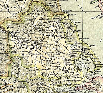
Oxyneia or Oxynia (Ancient Greek: Ὀξύνεια), or Oxynium or Oxynion (Ὀξύνιον), was a town and polis (city-state)[1] of ancient Thessaly, situated on the , a tributary of the Peneius, and perhaps the capital of the Talares. It is described by Strabo as distant 120 stadia from Azorus.[2]
It is cited as a place that provided a theorodokos to Epidaurus in 359 BCE.[3]
Its site in unknown.[4] It has traditionally been located in old Meritsa, which is currently called but that location does not seem to be compatible with Strabo's description, like another suggested location . Another place where it has been suggested that it could have been and that fits more with Strabo's data is a hill near Dasochori.[1]
References[]
- ^ Jump up to: a b Mogens Herman Hansen & Thomas Heine Nielsen (2004). "Thessaly and Adjacent Regions". An inventory of archaic and classical poleis. New York: Oxford University Press. p. 699. ISBN 0-19-814099-1.
- ^ Strabo. Geographica. 7.7.9. Page numbers refer to those of Isaac Casaubon's edition.
- ^ IG IV² 1.94.b.1.
- ^ Richard Talbert, ed. (2000). Barrington Atlas of the Greek and Roman World. Princeton University Press. p. 55, and directory notes accompanying.
![]() This article incorporates text from a publication now in the public domain: Smith, William, ed. (1854–1857). "Oxyneia". Dictionary of Greek and Roman Geography. London: John Murray.
This article incorporates text from a publication now in the public domain: Smith, William, ed. (1854–1857). "Oxyneia". Dictionary of Greek and Roman Geography. London: John Murray.
This article about a location in ancient Thessaly is a stub. You can help Wikipedia by . |
- Populated places in ancient Thessaly
- Former populated places in Greece
- Lost ancient cities and towns
- Histiaeotis
- Thessalian city-states
- Cities in ancient Greece
- Ancient Thessaly geography stubs