Pōhara
Pōhara | |
|---|---|
Settlement | |
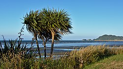 A Cabbage tree on Pōhara Beach | |
 | |
| Coordinates: 40°50′02″S 172°53′06″E / 40.834°S 172.885°ECoordinates: 40°50′02″S 172°53′06″E / 40.834°S 172.885°E | |
| Country | New Zealand |
| Territorial authority | Tasman |
| Ward | Golden Bay Ward |
| Area | |
| • Total | 8.06 km2 (3.11 sq mi) |
| Population (2018)[2] | |
| • Total | 516 |
| • Density | 64/km2 (170/sq mi) |

Pōhara is a rural locality in the Tasman District of New Zealand's South Island. The locality is northeast of Tākaka and southwest of Tata Beach. To the north is , part of Golden Bay / Mohua
The official spelling was changed from "Pohara" to "Pōhara" by the New Zealand Geographic Board Ngā Pou Taunaha o Aotearoa on 5 November 2018.[3]
In the peak holiday season between Christmas and the end of the year, Pōhara beach has up to 700 visitors a day.[4]
Demographics[]
Pōhara[]
| Year | Pop. | ±% p.a. |
|---|---|---|
| 2006 | 504 | — |
| 2013 | 507 | +0.08% |
| 2018 | 516 | +0.35% |
| Source: [2] | ||
Pōhara, comprising the SA1 statistical areas of 7022534, 7022535, 7022536 and 7022539, covers 8.04 km2 (3.10 sq mi).[1] It had a population of 516 at the 2018 New Zealand census, an increase of 9 people (1.8%) since the 2013 census, and an increase of 12 people (2.4%) since the 2006 census. There were 231 households. There were 240 males and 282 females, giving a sex ratio of 0.85 males per female, with 69 people (13.4%) aged under 15 years, 30 (5.8%) aged 15 to 29, 264 (51.2%) aged 30 to 64, and 150 (29.1%) aged 65 or older.
Ethnicities were 95.9% European/Pākehā, 7.0% Māori, 2.9% Asian, and 1.7% other ethnicities (totals add to more than 100% since people could identify with multiple ethnicities).
Although some people objected to giving their religion, 61.0% had no religion, 25.0% were Christian, 1.2% were Buddhist and 4.1% had other religions.
Of those at least 15 years old, 111 (24.8%) people had a bachelor or higher degree, and 66 (14.8%) people had no formal qualifications. The employment status of those at least 15 was that 159 (35.6%) people were employed full-time, 93 (20.8%) were part-time, and 12 (2.7%) were unemployed.[2]
Pōhara-Abel Tasman statistical area[]
The larger Pōhara-Abel Tasman SA2 statistical area also includes Motupipi and Tata Beach, and covers 326.05 km2 (125.89 sq mi).[1] It had an estimated population of 1,570 as of June 2021,[5] with a population density of 4.8 people per km2.
| Year | Pop. | ±% p.a. |
|---|---|---|
| 2006 | 1,422 | — |
| 2013 | 1,443 | +0.21% |
| 2018 | 1,470 | +0.37% |
| Source: [6] | ||
Pōhara-Abel Tasman had a population of 1,470 at the 2018 New Zealand census, an increase of 27 people (1.9%) since the 2013 census, and an increase of 48 people (3.4%) since the 2006 census. There were 597 households. There were 708 males and 762 females, giving a sex ratio of 0.93 males per female. The median age was 50.4 years (compared with 37.4 years nationally), with 234 people (15.9%) aged under 15 years, 159 (10.8%) aged 15 to 29, 744 (50.6%) aged 30 to 64, and 330 (22.4%) aged 65 or older.
Ethnicities were 94.3% European/Pākehā, 7.1% Māori, 0.8% Pacific peoples, 2.0% Asian, and 2.4% other ethnicities (totals add to more than 100% since people could identify with multiple ethnicities).
The proportion of people born overseas was 22.2%, compared with 27.1% nationally.
Although some people objected to giving their religion, 64.3% had no religion, 21.4% were Christian, 0.6% were Hindu, 1.4% were Buddhist and 3.9% had other religions.
Of those at least 15 years old, 276 (22.3%) people had a bachelor or higher degree, and 186 (15.0%) people had no formal qualifications. The median income was $25,300, compared with $31,800 nationally. The employment status of those at least 15 was that 471 (38.1%) people were employed full-time, 297 (24.0%) were part-time, and 33 (2.7%) were unemployed.[6]
References[]
- ^ a b c "ArcGIS Web Application". statsnz.maps.arcgis.com. Retrieved 23 July 2021.
- ^ a b c "Statistical area 1 dataset for 2018 Census". Statistics New Zealand. March 2020. 7022534, 7022535, 7022536 and 7022539.
- ^ "Notice of Approved Official Geographic Names". New Zealand Gazette Te Kāhiti o Aotearoa. 5 November 2018.
- ^ "Pōhara Beach". Tasman District Council. Retrieved 23 July 2021.
- ^ "Population estimate tables - NZ.Stat". Statistics New Zealand. Retrieved 22 October 2021.
- ^ a b "Statistical area 1 dataset for 2018 Census". Statistics New Zealand. March 2020. Pōhara-Abel Tasman (300600). 2018 Census place summary: Pōhara-Abel Tasman
- Populated places in the Tasman District