Palermo, Montevideo
Palermo | |
|---|---|
 Conjunto Habitacional Rambla | |
 Street map of Palermo | |
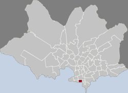 Location of Palermo in Montevideo | |
| Coordinates: 34°54′44″S 56°10′53″W / 34.91222°S 56.18139°WCoordinates: 34°54′44″S 56°10′53″W / 34.91222°S 56.18139°W | |
| Country | |
| Department | Montevideo Department |
| City | Montevideo |

Palermo is a barrio (neighbourhood or district) of Montevideo, Uruguay.
Location[]
Palermo shares borders with Barrio Sur to the west, Cordón to the north and Parque Rodó to the east, while to the south it borders the coastline, with Rambla República de Argentina running along it.
Landmarks[]
It is home to the Arts and Trades School, ALADI and the , seat of the parliament of the Mercosur member countries.[1]
Places of worship[]
- Church and convent of St. Anthony and St. Clare (Roman Catholic, Friars Minor Capuchin)
- (Roman Catholic)
See also[]
External links[]
| Wikimedia Commons has media related to Palermo, Montevideo. |
Notes[]
- ^ "Visitas al Parlamento". Parlamento del Mercosur. Archived from the original on 2011-05-13. Retrieved 2010-11-26.
| hide Barrios of Montevideo | ||
|---|---|---|
 |
| |
| show Authority control |
|---|
This Montevideo-related article is a stub. You can help Wikipedia by . |
Categories:
- Barrios of Montevideo
- Palermo, Montevideo
- Montevideo stubs