Unión, Montevideo
Unión | |
|---|---|
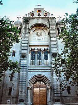 Iglesia de la Unión | |
 Street map of Unión | |
 Location of Unión in Montevideo | |
| Coordinates: 34°52′43″S 56°8′9″W / 34.87861°S 56.13583°WCoordinates: 34°52′43″S 56°8′9″W / 34.87861°S 56.13583°W | |
| Country | |
| Department | Montevideo Department |
| City | Montevideo |

Unión is a barrio (neighbourhood or district) of Montevideo, Uruguay.
Location[]
Unión shares borders with Mercado Modelo and Villa Española to the northwest, Maroñas to the northeast, Malvín Norte to the east, Buceo and Parque Batlle to the south and La Blanqueada and Larrañaga to the southwest.
History[]
Its history started in 1845, during General Oribe's siege of Montevideo, which at the time was little more than the actual Ciudad Vieja, by the creation of the Tribunal of Unión in the area. In 1849, Oribe founded here a village called "Restauración". After the end of the civil war, its status was elevated from "Pueblo" (village) to "Villa" (town) and was renamed to "Villa de la Unión" by Decree of 11 November 1851.[1]
Educational facilities[]
- (private, established 1919 by the Vicentian Sisters, lay since 1993)[2]
Places of worship[]
- Sanctuary of the Miraculous Medal and St. Augustine, popularly known as "Iglesia de la Unión" (Roman Catholic, Congregation of the Mission)
- (Roman Catholic)
- (Roman Catholic)
Bibliography[]
- Assunção, Fernando O.; (1991). La Unión. Cuadernos del Boston (in Spanish). 3. Montevideo.
See also[]
References[]
- ^ "Statistics of urban localities (see "Restauración")" (PDF). INE. 2012. Retrieved 9 September 2012.
- ^ Colegio y Liceo Santa Luisa de Marillac (in Spanish)
External links[]
| Wikimedia Commons has media related to La Unión, Montevideo. |
- Intendencia de Montevideo / Historia de Unión
- Revista Raices / Historia del barrio Unión
- Correo Uruguayo Stamp for the 150 years from the foundation of Villa de la Restauración, including notes on the history of Unión by Rubens D. Calabria.
| hide Barrios of Montevideo | ||
|---|---|---|
 |
| |
| show Authority control |
|---|
This Montevideo-related article is a stub. You can help Wikipedia by . |
- Barrios of Montevideo
- Unión, Montevideo
- Montevideo stubs