
Pamidimukkala mandal
Pamidimukkala Mandal | |
|---|---|
Mandal | |
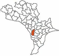 Mandal Map of Krishna District showing Pamidimukkala Mandal (in Orange) | |
 Pamidimukkala Mandal Location in Andhra Pradesh, India | |
| Coordinates: 16°17′33″N 80°51′58″E / 16.292487°N 80.866058°E | |
| Country | India |
| State | Andhra Pradesh |
| District | Krishna |
| Headquarters | Veerankilaku |
| Elevation | 14 m (46 ft) |
| Population (2011)[1] | |
| • Total | 53,913 |
| Languages | |
| • Official | Telugu |
| Time zone | UTC+5:30 (IST) |
| PIN | 521 XXX |
| Telephone code | +91-08676 |
| Vehicle registration | AP 16 |
Pamidimukkala Mandal is one of the 50 Mandals in the Krishna District of the Indian State of Andhra Pradesh.[3] it is 39 km from Vijayawada.
There are 28 Villages within the Pamidimukkala mandal. it is also a part of Capital of Andhra Pradesh (APCRDA). The headquarters of Pamidimukkala mandal is located in Veerankilaku. Chennuruvaripalem is the least populated and Kapileswarapuram is the most highly populated village in Pamidimukkala mandal.
Villages[]
As of 2011 Census, Pamidimukkala Mandal has 21 villages.[2]
The settlements in the mandal are:
- Aginiparru
- Ameenapuram
- Chennuruvaripalem
- Choragudi
- Fathelanka
- Gopuvanipalem
- Gurazada
- Hanumanthapuram
- Inampudi
- Inapuru
- Kapileswarapuram
- Krishnapuram
- Kuderu
- Lankapalle
- Mamillapalle
- Mantada
- Marrivada
- Meduru
- Mullapudi
- Pamidimukkala(Veerankilaku)
- Penumatcha
References[]
- ^ "Census 2011". The Registrar General & Census Commissioner, India. Retrieved 12 September 2014.
- ^ a b "District Census Handbook - Krishna" (PDF). Census of India. p. 16,418. Retrieved 3 March 2016.
- ^ "Census 2011 Krishna district". Retrieved 6 November 2017.
Categories:
- Mandals in Krishna district
- Krishna district geography stubs