Patensie
Patensie | |
|---|---|
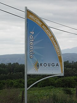 Signboard on the R331 outside Patensie | |
 Patensie | |
| Coordinates: 33°45′32″S 24°48′53″E / 33.75889°S 24.81472°ECoordinates: 33°45′32″S 24°48′53″E / 33.75889°S 24.81472°E | |
| Country | South Africa |
| Province | Eastern Cape |
| District | Sarah Baartman |
| Municipality | Kouga |
| Established | 1858 [1] |
| Area | |
| • Total | 6.23 km2 (2.41 sq mi) |
| Population (2011)[2] | |
| • Total | 5,263 |
| • Density | 840/km2 (2,200/sq mi) |
| Racial makeup (2011) | |
| • Black African | 39.7% |
| • Coloured | 50.2% |
| • Indian/Asian | 0.2% |
| • White | 8.0% |
| • Other | 1.9% |
| First languages (2011) | |
| • Afrikaans | 70.0% |
| • Xhosa | 24.9% |
| • English | 1.4% |
| • Other | 3.7% |
| Time zone | UTC+2 (SAST) |
| Postal code (street) | 6335 |
| PO box | 6335 |
| Area code | 042 |
| Website | www.patensie-is-lekker.co.za |


Patensie is a town in Sarah Baartman District Municipality in the Eastern Cape province of South Africa. Patensie lies along the R331 road just south of . The Kouga Dam is located several kilometres to the west. The name is Khoi in origin, and means "cattle resting place".[3] The town is a centre for the citrus, tobacco, and vegetable farms in the area.[3]
References[]
- ^ "Patensie". Gamtoos Tourism. Retrieved 25 February 2012.
- ^ a b c d "Main Place Patensie". Census 2011.
- ^ a b "Cacadu Region". Revealed.co.za. Archived from the original on 3 September 2014. Retrieved 28 August 2014.
External links[]
| Wikivoyage has a travel guide for Patensie. |
| Wikimedia Commons has media related to Patensie. |
This Eastern Cape location article is a stub. You can help Wikipedia by . |
Municipalities and communities of Sarah Baartman District Municipality, Eastern Cape | ||
|---|---|---|
District seat: Port Elizabeth | ||
| Blue Crane Route |  | |
| Dr Beyers Naudé | ||
| Kouga | ||
| Kou-Kamma | ||
| Makana |
| |
| Ndlambe |
| |
| Sunday's River Valley | ||
Categories:
- Eastern Cape geography stubs
- Populated places in the Kouga Local Municipality