Patoka Township, Crawford County, Indiana
Patoka Township | |
|---|---|
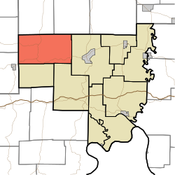 Location of Patoka Township in Crawford County | |
| Coordinates: 38°21′18″N 86°36′23″W / 38.35500°N 86.60639°WCoordinates: 38°21′18″N 86°36′23″W / 38.35500°N 86.60639°W | |
| Country | United States |
| State | Indiana |
| County | Crawford |
| Named for | Patoka River or Patoka Lake, both located within the township. |
| Government | |
| • Type | Indiana township |
| Area | |
| • Total | 45.65 sq mi (118.2 km2) |
| • Land | 43.65 sq mi (113.1 km2) |
| • Water | 2 sq mi (5 km2) |
| Elevation | 709 ft (216 m) |
| Population (2010) | |
| • Total | 1,579 |
| • Density | 36.2/sq mi (14.0/km2) |
| FIPS code | 18-58284[2] |
| GNIS feature ID | 453707 |

Patoka Township is one of nine townships in Crawford County, Indiana. As of the 2010 census, its population was 1,579 and it contained 1,076 housing units.[3]
Geography[]
According to the 2010 census, the township has a total area of 45.65 square miles (118.2 km2), of which 43.65 square miles (113.1 km2) (or 95.62%) is land and 2 square miles (5.2 km2) (or 4.38%) is water.[3]
Unincorporated towns[]
(This list is based on USGS data and may include former settlements.)
Adjacent townships[]
- Jackson Township, Orange County (north)
- Greenfield Township, Orange County (northeast)
- Sterling Township (east)
- Union Township (southeast)
- Jefferson Township, Dubois County (southwest)
- Johnson Township (southwest)
- Hall Township, Dubois County (west)
Major highways[]
Cemeteries[]
The township contains four cemeteries: Brown, Eckerty, Mount Eden and Williams.
References[]
- ^ "US Board on Geographic Names". United States Geological Survey. 2007-10-25. Retrieved 2008-01-31.
- ^ "U.S. Census website". United States Census Bureau. Retrieved 2008-01-31.
- ^ a b "Population, Housing Units, Area, and Density: 2010 - County -- County Subdivision and Place -- 2010 Census Summary File 1". United States Census. Archived from the original on 2020-02-12. Retrieved 2013-05-10.
External links[]
Municipalities and communities of Crawford County, Indiana, United States | ||
|---|---|---|
| Towns | ||
| Townships | ||
| Unincorporated communities | ||
| Footnotes | ‡This populated place also has portions in an adjacent county or counties | |
| ||
Categories:
- Townships in Crawford County, Indiana
- Townships in Indiana