Paucartambo Province
Paucartambo | |
|---|---|
 Paucartambo | |
 Flag | |
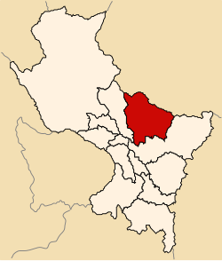 Location of Paucartambo in the Cusco Region | |
| Country | Peru |
| Region | Cusco |
| Capital | Paucartambo |
| Government | |
| • Mayor | Mario Condori Huallpa (2007) |
| Area | |
| • Total | 6,295.01 km2 (2,430.52 sq mi) |
| Population (2005 census) | |
| • Total | 47,313 |
| • Density | 7.5/km2 (19/sq mi) |
| UBIGEO | 0811 |
Paucartambo Province (from Quechua: Pawqar Tampu,[1] meaning "colo(u)red tambo") is one of thirteen provinces in the Cusco Region in the southern highlands of Peru.
Boundaries[]
- North: Madre de Dios Region
- East: Quispicanchi Province
- South: Quispicanchi Province
- West: Calca Province
Geography[]
Some of the highest mountains of the province are listed below:[2]
- Ananta Q'asa
- Anti Pukara
- Apachita Q'asa
- Aqu Urqu
- Atuq Wachana
- Chawpi Urqu
- Chupa Kancha
- Hatun Allpapata
- Inti Qhawarina
- Jach'a Sira
- Kuntur Sinqa
- Luychu Urqu
- Llama Kunka
- Minasniyuq
- Pukara
- Pukara Q'asa
- Pumakancha
- P'allqa Qaqa
- P'unquchayuq
- Qhispi Rumiyuq
- Qullpa Qhata
- Qullqi Urquna
- Qullqip'unqu
- Qullqiri
- Quri
- Q'illu Unuyuq
- Raqch'i Raqch'iyuq
- Saywa Urqu
- Suni Urqu
- Tawa Pukara
- Tawqa
- Uqayuq
- Wankarani
- Willulluni
- Yana Urqu
Political division[]
The province is divided into six districts (Spanish: distritos, singular: distrito), each of which is headed by a mayor (alcalde). The districts, with their capitals in parenthesis, are:
- Caicay ()
- Challabamba ()
- Colquepata ()
- Huancarani (Huancarani)
- Kosñipata ()
- Paucartambo (Paucartambo)
Ethnic groups[]
The people in the province are mainly indigenous citizens of Quechua ethnicity. According to the 2007 national census, Quechua is the first language of the great majority of the population (85.56%); 13.51% of the residents learned Spanish as their first language (2007 Peru Census).[3]
See also[]
- Chukchu
- Ch'unchu
- Ninamarka
- Qhapaq negro
- Qhapaq Qulla
- Saqra
Sources[]
- ^ Nonato Rufino Chuquimamani Valer, Carmen Gladis Alosilla Morales, Victoria Choque Valer: Qullaw Qichwapa Simi Qullqan. Lima, 2014 Archived 2014-11-29 at the Wayback Machine
- ^ escale.minedu.gob.pe - UGEL map of the Quispicanchi Province 1 (Cusco Region)
- ^ inei.gob.pe Archived 2013-01-27 at the Wayback Machine INEI, Peru, Censos Nacionales 2007
| show Authority control |
|---|
Coordinates: 13°19′12″S 71°35′34″W / 13.319889°S 71.592751°W

This Cusco Region geography article is a stub. You can help Wikipedia by . |
- Provinces of the Cusco Region
- Cusco Region geography stubs