Paulding, Michigan
Paulding, Michigan | |
|---|---|
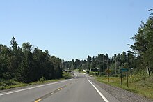
 Community of Paulding along U.S. Route 45 | |
 Paulding Location within the state of Michigan | |
| Coordinates: 46°24′05″N 89°10′48″W / 46.40139°N 89.18000°WCoordinates: 46°24′05″N 89°10′48″W / 46.40139°N 89.18000°W[1] | |
| Country | United States |
| State | Michigan |
| County | Ontonagon |
| Township | Haight |
| Elevation | 1,358 ft (414 m) |
| Time zone | UTC-5 (Eastern (EST)) |
| • Summer (DST) | UTC-4 (EDT) |
| ZIP code(s) | 49912 (Bruce Crossing) |
| Area code(s) | 906 |
| GNIS feature ID | 1621164[1] |


Paulding is an unincorporated community in Ontonagon County in the U.S. state of Michigan. Paulding is located in Haight Township along U.S. Route 45, 13.5 miles (21.7 km) southeast of the village of Ontonagon.[2] The Paulding Light, part of the area's folklore, is visible in a valley near Paulding.
History[]
A post office called Paulding was established in 1893, and remained in operation until it was discontinued in 1971.[3] The community was named for John Paulding, a militiaman in the American Revolution.[4]
Paulding sign
References[]
- ^ a b c U.S. Geological Survey Geographic Names Information System: Paulding, Michigan
- ^ Ontonagon County (pdf) (Map). Michigan Department of Technology, Management and Budget. 2010. Retrieved 7 May 2011.
- ^ "Ontonagon County". Jim Forte Postal History. Retrieved 24 March 2015.
- ^ Chicago and North Western Railway Company (1908). A History of the Origin of the Place Names Connected with the Chicago & North Western and Chicago, St. Paul, Minneapolis & Omaha Railways. p. 112.
Municipalities and communities of Ontonagon County, Michigan, United States | ||
|---|---|---|
| Village |  | |
| Civil townships | ||
| CDPs | ||
| Other communities |
| |
| Ghost town | ||
| Indian reservation | ||
| ||
This Ontonagon County, Michigan location article is a stub. You can help Wikipedia by . |
Categories:
- Unincorporated communities in Ontonagon County, Michigan
- Unincorporated communities in Michigan
- Upper Peninsula, Michigan geography stubs