Pay-Khoy Ridge
| Pay-Khoy Ridge | |
|---|---|
 Folded layers of rock of the Pay-Khoy Ridge at Silovayaha River | |
| Highest point | |
| Elevation | 467 m (1,532 ft) |
| Coordinates | 69°12′13″N 62°36′28″E / 69.203553°N 62.607785°ECoordinates: 69°12′13″N 62°36′28″E / 69.203553°N 62.607785°E |
| Geography | |
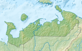 Pay-Khoy Ridge Location | |
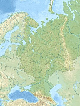
| Location | Nenets Autonomous Okrug, Russia |

The Pay-Khoy ridge (Russian: хребет Пай-Хой) is a mountain range at the northern end of the Ural Mountains. It lies within the Nenets Autonomous Okrug.
Geography[]

The ridge is extended from northwest to southeast. It is located on the Yugorsky Peninsula, in the eastern part of the Nenets Autonomous Okrug. The ridge continues to Vaygach Island, thus separating the Barents Sea and the Kara Sea. The highest point of Pay-Khoy is the mountain of (467 metres (1,532 ft)).[1] The ridge separates the drainage basins of the (west, Barents Sea) and the Kara River (east, Kara Sea).
The areas around Pay-Khoy do not have permanent population. The closest permanent settlements are Amderma and . The ridge is located in tundra, to the north of the tree line.
Geology[]
The Pay-Khoy ridge forms a curved orogen together with the Ural Mountains, Vaygach Island and the Novaya Zemlya archipelago. The Pay-Khoy and Novaya Zemlya are younger than the orogeny that formed the Ural mountains. They were formed during the Cimmerian Orogeny between the Late Triassic and Early Jurassic.[2]
References[]
- ^ Пай-Хой. Great Soviet Encyclopedia.
- ^ Lindquist, Sandra J. (1999). The Timan-Pechora Basin Province of Northwest Arctic Russia: Domanik – Paleozoic Total Petroleum System (PDF). U. S. Geological Survey. p. 40. Retrieved 13 October 2012.[permanent dead link]
| Authority control |
|---|
- Mountain ranges of Russia
- Landforms of Nenets Autonomous Okrug
- Ural Mountains