Peasey Beck
| Peasey Beck | |
|---|---|
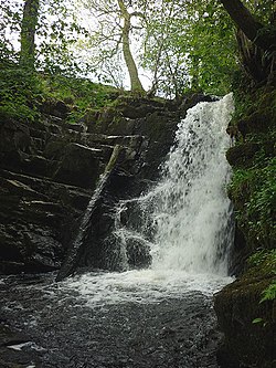 Waterfall on the Peasey Beck near Old Hutton | |
 Location of the mouth within Cumbria | |
| Location | |
| Country | England |
| County | Cumbria |
| Physical characteristics | |
| Mouth | |
• location | River Bela at Milnthorpe |
• coordinates | 54°13′28″N 2°44′27″W / 54.2245°N 2.7407°WCoordinates: 54°13′28″N 2°44′27″W / 54.2245°N 2.7407°W |
| Length | 19.6 km (12.2 mi) |

Peasey Beck is a 19.6-kilometre-long (12.2 mi) beck flowing through Cumbria, England. It rises on Lambrigg Fell where it is known as the Killington Beck, flows through Killington Reservoir and converges with Stainton Beck to form the River Bela at Milnthorpe.[1]
Course[]
The source of the beck is on Lambrigg Fell at 300 metres (980 ft) (grid reference SD 590 910) between Kendal and Sedbergh where it is known as the Killington Beck.
Killington Reservoir[]
About 0.97 kilometres (0.6 mi) from its source it is dammed and forms the Killington Reservoir or Killington Lake. The Lancaster Canal were empowered by an Act of Parliament obtained in 1807 to deviate from their original route, and to extract water from Farleton Beck, Stainton Beck and Crooklands Beck (later called Peasey Beck), rather than the River Mint. They bought 86 acres (35 ha) of land in 1810, in order to build the reservoir, but over-stretched themselves, and construction had to wait until they had raised more money. It was eventually completed in 1819. It now covers an area of 140 acres (57 ha), as its banks have been raised several times.[2] The M6 motorway passes immediately to the west of the reservoir, and Killington Lake Services, which is only accessible to southbound drivers, is situated on the bank. The services were built in 1972, soon after the motorway opened.[3]
The reservoir offers fishing for rainbow and brown trout and of coarse fish: pike, tench and bream. Day tickets are available and the lake is easily accessible from the M6 motorway.[4]
Below the dam, the water is not carried to the canal in an aqueduct; the reservoir merely controls the flow in the beck. A small dam about 9.7 kilometres (6 mi) downstream near Crooklands diverts water into the canal. By this time, the beck has become the Peasey Beck which joins the River Bela near Milnthorpe and that in turn joins the River Kent.[5]
See also[]
References[]
- ^ "Peasey Beck". Catchment Data Explorer. Environment Agency. Retrieved 1 November 2017.
- ^ Charles Hadfield; Gordon Biddle (1970). The Canals of North West England, Vol 1 (pp.1-236). David and Charles. pp. 192–193. ISBN 0-7153-4956-2.
- ^ Motorway Services Online, Killington Lake, accessed 14 October 2010
- ^ Kent (Westmorland) Angling Association, Killington Lake Reservoir, accessed 14 October 2010
- ^ Ordnance Survey, 1:25000 map, Sheet OL7
External links[]
- Rivers of Cumbria
- Kent catchment
- South Lakeland District