Penn State Erie (Behrend), Pennsylvania
Penn State Erie (Behrend), Pennsylvania | |
|---|---|
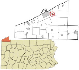 Location in Erie County and the state of Pennsylvania | |
| Coordinates: 42°07′06″N 79°58′54″W / 42.11833°N 79.98167°WCoordinates: 42°07′06″N 79°58′54″W / 42.11833°N 79.98167°W | |
| Country | United States |
| State | Pennsylvania |
| County | Erie |
| Township | Harborcreek |
| Area | |
| • Total | 0.8 sq mi (2.0 km2) |
| • Land | 0.8 sq mi (2.0 km2) |
| • Water | 0.0 sq mi (0.0 km2) |
| Elevation | 1,070 ft (330 m) |
| Population (2010) | |
| • Total | 1,629 |
| • Density | 2,078/sq mi (802.4/km2) |
| Time zone | UTC-5 (Eastern (EST)) |
| • Summer (DST) | UTC-4 (EDT) |
| FIPS code | 42-59212 |
| GNIS feature ID | 2633746 |

Penn State Erie (Behrend) is a census-designated place[1] located in Harborcreek Township, Erie County in the U.S. state of Pennsylvania. It is located around the campus of Penn State Erie and near the city of Erie. As of the 2010 census the population was 1,629.[2]
References[]
- ^ "By Decade".
- ^ "Geographic Identifiers: 2010 Census Summary File 1 (G001): Penn State Erie (Behrend) CDP, Pennsylvania". American Factfinder. U.S. Census Bureau. Archived from the original on February 13, 2020. Retrieved March 22, 2016.
External links[]
Municipalities and communities of Erie County, Pennsylvania, United States | ||
|---|---|---|
| Cities |  | |
| Boroughs | ||
| Townships | ||
| CDPs |
| |
| Unincorporated communities | ||
| ||
This Erie County, Pennsylvania location article is a stub. You can help Wikipedia by . |
Categories:
- Census-designated places in Erie County, Pennsylvania
- Western Pennsylvania geography stubs