Penperlleni

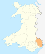
Penperlleni is a hamlet within community and electoral ward of Goetre Fawr in Monmouthshire, Wales.
Etymology[]
The name of Penperlleni derives from two Welsh words, Pen refers to the summit or top of a hill, the second element perlleni, has been interpreted as meaning a "round mass" and an "area of round hills", although the current Welsh word for orchard (perllan) may apply.[1]
History and amenities[]

Penperlleni was previously known as Pelleny (1256), Pethllenny (1330), Pelleny (1349) and Pellenig (1593).[1] Penperlleni has a number of amenities, including a primary school, Goytre Fawr Primary School and a church, Capel Ed, a public house, the Goytre Arms and a village hall and post office.
Penperlleni lies on the Newport–Shrewsbury Trunk Road (A4042 road).
References[]
- ^ a b "Goytre and Penperleni Villages (424477)". Coflein. RCAHMW. Retrieved 6 October 2020.
External links[]
 Media related to Penperlleni at Wikimedia Commons
Coordinates: 51°44′11″N 2°58′57″W / 51.73639°N 2.98250°W

- Villages in Monmouthshire