Peterson Glacier
From Wikipedia, the free encyclopedia
Glacier in Antarctica
| Peterson Glacier | |
|---|---|
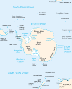 Map of Antarctica, with Wilkes Land slightly to the right | |
 Location of Peterson Glacier in Antarctica | |
| Location | Wilkes Land |
| Coordinates |  66°25′00″S 110°44′00″E / 66.41667°S 110.73333°E / -66.41667; 110.73333 66°25′00″S 110°44′00″E / 66.41667°S 110.73333°E / -66.41667; 110.73333 |
| Thickness | unknown |
| Terminus | Penney Bay |
| Status | unknown |
Peterson Glacier is a glacier flowing west into Penney Bay opposite Herring Island in the Windmill Islands. Mapped from aerial photographs taken by U.S. Navy (USN) OpHjp, 1946–47, and named for Louie N. Peterson, radio operator and recorder with the U.S. Navy (USN) OpWml parties which established astronomical control stations along Wilhelm II, Knox and Budd Coasts during January–February 1948.[1]
See also[]
- List of glaciers in the Antarctic
- Glaciology
References[]
- ^ "Peterson Glacier". Geographic Names Information System. United States Geological Survey. Retrieved 2010-08-10.
Coordinates: 66°25′S 110°44′E / 66.417°S 110.733°E / -66.417; 110.733
Portal: Geography
Glaciers | |||||||
|---|---|---|---|---|---|---|---|
| Types |
| ||||||
| Anatomy |
| ||||||
| Processes |
| ||||||
| Measurements |
| ||||||
| Volcanic relations | |||||||
| Landforms |
| ||||||
| |||||||
Glaciers in the Antarctic | |
|---|---|
|
Glaciers of Wilkes Land | |
|---|---|
|
This article about a glacier in Wilkes Land is a stub. You can help Wikipedia by . |
- v
- t
Retrieved from ""
Categories:
- Glaciers of Wilkes Land
- Wilkes Land geography stubs
- Antarctica glacier stubs
Hidden categories:
- Articles with short description
- Short description matches Wikidata
- Coordinates on Wikidata
- All stub articles