Phù Cát District
show This article may be expanded with text translated from the corresponding article in Vietnamese. (March 2009) Click [show] for important translation instructions. |
Phù Cát District
Huyện Phù Cát | |
|---|---|
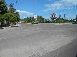 A corner of Ngo May town in Phù Cát District | |
 | |
 Phù Cát District Location of in Vietnam | |
| Coordinates: 13°59′N 109°3′E / 13.983°N 109.050°ECoordinates: 13°59′N 109°3′E / 13.983°N 109.050°E | |
| Country | |
| Region | South Central Coast |
| Province | Bình Định Province |
| Capital | Ngô Mây |
| Area | |
| • Total | 680 km2 (260 sq mi) |
| Population (2018)[1] | |
| • Total | 210,300 |
| Time zone | UTC+7 (Indochina Time) |

Phù Cát is a district (huyện) of Bình Định Province in the South Central Coast region of Vietnam.
The district capital lies at Ngô Mây.[2]
The district is also home to Phu Cat Airport.
References[]
- ^ Bình Định Statistics Office (2010): Bình Định Statistical Yearbook 2009. Statistical Publishing House, Hanoi
- ^ "Districts of Vietnam". Statoids. Retrieved March 13, 2009.

| show Authority control |
|---|
This article about a location in Bình Định Province, Vietnam is a stub. You can help Wikipedia by . |
Categories:
- Districts of Bình Định Province
- South Central Coast geography stubs