Sơn Trà District
show This article may be expanded with text translated from the corresponding article in Vietnamese. (March 2009) Click [show] for important translation instructions. |
Sơn Trà District
Quận Sơn Trà | |
|---|---|
 | |
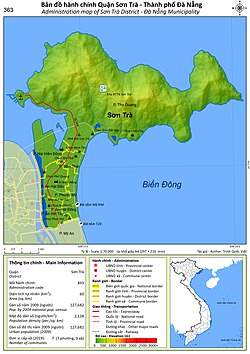 Administration map of the district in Da Nang | |
| Country | |
| Region | South Central Coast |
| Municipality | Da Nang |
| Capital | Da Nang |
| Area | |
| • Total | 20 sq mi (60 km2) |
| Population (2018) | |
| • Total | 173,455 |
| Time zone | UTC+7 (Indochina Time) |
Sơn Trà is an urban district (quận) of Da Nang in the South Central Coast region of Vietnam. As of 2003 the district had a population of 112,196. The district covers an area of 60 km².[1] The district is bounded by ocean to the north and east, the Hàn River to the west, and Ngũ Hành Sơn District to the south. Sơn Trà Mountain occupies a large portion of the district.

Đà Nẵng Political School
The district is divided into 7 wards:
- An Hải Bắc
- An Hải Đông
- An Hải Tây
- Mân Thái
- Nại Hiên Đông
- Phước Mỹ
- Thọ Quang
References[]
- ^ "Districts of Vietnam". Statoids. Retrieved March 20, 2009.
Coordinates: 16°06′58″N 108°16′37″E / 16.116°N 108.277°E


| show Authority control |
|---|
Categories:
- Districts of Da Nang
- South Central Coast geography stubs