Philadelphia Municipal Airport
Philadelphia Municipal Airport | |||||||||||
|---|---|---|---|---|---|---|---|---|---|---|---|
| Summary | |||||||||||
| Airport type | Public | ||||||||||
| Owner | City of Philadelphia | ||||||||||
| Serves | Philadelphia, Mississippi | ||||||||||
| Elevation AMSL | 458 ft / 140 m | ||||||||||
| Coordinates | 32°47′57″N 089°07′34″W / 32.79917°N 89.12611°WCoordinates: 32°47′57″N 089°07′34″W / 32.79917°N 89.12611°W | ||||||||||
| Website | http://www.philadelphiathecity.com/philadelphia-municipal-airport | ||||||||||
| Map | |||||||||||
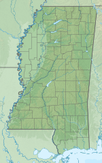 MPE Location of airport in Mississippi | |||||||||||
| Runways | |||||||||||
| |||||||||||
| Statistics (2012) | |||||||||||
| |||||||||||

Philadelphia Municipal Airport (ICAO: KMPE, FAA LID: MPE) is a public use airport in Neshoba County, Mississippi, United States.[1] It is owned by the City of Philadelphia and located two nautical miles (4 km) northwest of its central business district.[1] This airport is included in the National Plan of Integrated Airport Systems for 2011–2015, which categorized it as a general aviation facility.[2]
Although many U.S. airports use the same three-letter location identifier for the FAA and IATA, this airport is assigned MPE by the FAA[1] but has no designation from the IATA[3] (which assigned MPE to Griswold Airport in Madison, Connecticut).[4]
Facilities and aircraft[]
Philadelphia Municipal Airport covers an area of 60 acres (24 ha) at an elevation of 458 feet (140 m) above mean sea level. It has one runway designated 18/36 with an asphalt surface measuring 5,001 by 75 feet (1,524 x 23 m).[1]
For the 12-month period ending March 20, 2012, the airport had 13,300 aircraft operations, an average of 36 per day: 98.5% general aviation and 1.5% military. At that time there were 8 aircraft based at this airport: 75% single-engine, 12.5% multi-engine, and 12.5% jet.[1]
See also[]
References[]
- ^ a b c d e f FAA Airport Form 5010 for MPE PDF. Federal Aviation Administration. Effective November 15, 2012.
- ^
"2011–2015 NPIAS Report, Appendix A" (PDF, 2.03 MB). National Plan of Integrated Airport Systems. Federal Aviation Administration. October 4, 2010.
{{cite web}}: External link in|work= - ^ "Philadelphia Municipal Airport (IATA: none, ICAO: KMPE, FAA: MPE)". Great Circle Mapper. Retrieved September 19, 2010.
- ^ "IATA Airport Code Search (MPE – City: Madison, Airport: Griswold)". International Air Transport Association. Retrieved August 14, 2013.
External links[]
- Aerial image as of March 1996 from USGS The National Map
- FAA Terminal Procedures for MPE, effective February 24, 2022
- Resources for this airport:
- FAA airport information for MPE
- AirNav airport information for MPE
- FlightAware airport information and live flight tracker
- SkyVector aeronautical chart for MPE
- Airports in Mississippi
- Buildings and structures in Neshoba County, Mississippi
- Transportation in Neshoba County, Mississippi
- Philadelphia, Mississippi