Philipp, Mississippi
Philipp, Mississippi | |
|---|---|
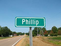 Highway sign, incorrectly spelled "Phillip" | |
 Philipp, Mississippi | |
| Coordinates: 33°45′27″N 90°12′15″W / 33.75750°N 90.20417°WCoordinates: 33°45′27″N 90°12′15″W / 33.75750°N 90.20417°W | |
| Country | United States |
| State | Mississippi |
| Counties | Tallahatchie |
| Elevation | 157 ft (48 m) |
| Time zone | UTC-6 (Central (CST)) |
| • Summer (DST) | UTC-5 (CDT) |
| ZIP code | 38950 |
| Area code(s) | 662 |
| GNIS feature ID | 675681[1] |


Philipp is an unincorporated community in southern Tallahatchie County, Mississippi, United States, along Mississippi Highway 8. Philipp is 6 miles (9.7 km) east of Minter City and 14 miles (23 km) west of Holcomb. Although Philipp is an unincorporated community, it has a post office with a ZIP code of 38950.[2]
History[]
The community was founded by Emanuel L. Philipp who was Governor of Wisconsin when he was the manager of a lumber company from 1894 to 1902 in Mississippi.[3][4]
Education[]
It is zoned to the West Tallahatchie School District.[5][6] The local schools for West Tallahatchie are R. H. Bearden Elementary School and West Tallahatchie High School.
At one time the Philipp Consolidated School was located in the community. In 1957 the West Tallahatchie district announced that the property was for sale.[7]
At a later point Black Bayou Elementary School in Glendora served southern parts of the West Tallahatchie district.[8] The district decided to close Black Bayou in 1998.[9] Previously West District Middle School (now Bearden) served as a middle school for the West Tallahatchie area.[8]
Coahoma Community College is the designated community college for Tallahatchie County.[10]
References[]
- ^ U.S. Geological Survey Geographic Names Information System: Philipp, Mississippi
- ^ ZIP Code Lookup
- ^ Wisconsin Historical Society-Emanuel L. Philipp
- ^ Governor Emanuel Philipp of Wisconsin, Wisconsin Historical Society
- ^ "2020 CENSUS - SCHOOL DISTRICT REFERENCE MAP: Tallahatchie County, MS" (PDF). U.S. Census Bureau. Retrieved 2021-05-20.
- ^ U.S. Geological Survey Geographic Names Information System: Philipp
- ^ "Notice for Sale". . Vol. 48, no. 52. 1957-07-18. p. 4. - Clipping from Newspapers.com
- ^ a b Mikell, Ray S. (1988-08-14). "West Tallahatchie students face longer classes, new staff". The Greenwood Commonwealth. Greenwood, Mississippi. p. 7A. - Clipping from Newspapers.com.
- ^ "West Tallahatchie schools launch building projects". . 1998-02-12. - Clipping from Newspapers.com.
- ^ "Student Residency" (Archive). Coahoma Community College. Retrieved on July 8, 2017. "Out-of-District Resident: A student who does not live within Bolivar, Coahoma, Quitman, Tallahatchie, and Tunica Counties but does live in some other county in Mississippi."

Philipp Volunteer Fire Department

Philipp Post Office


Municipalities and communities of Tallahatchie County, Mississippi, United States | ||
|---|---|---|
| City |  | |
| Towns | ||
| Village | ||
| Unincorporated communities | ||
| Ghost towns | ||
| Footnotes | ‡This populated place also has portions in an adjacent county or counties | |
| ||
This Tallahatchie County, Mississippi state location article is a stub. You can help Wikipedia by . |
- Unincorporated communities in Tallahatchie County, Mississippi
- Unincorporated communities in Mississippi
- Mississippi Delta region geography stubs