Phnom Dei
| Phnom Dei | |
|---|---|
| ឃុំភ្នំដី | |
 View of Phnom Dei | |
| Highest point | |
| Elevation | 272 m (892 ft) |
| Coordinates | 13°35′45″N 103°59′1″E / 13.59583°N 103.98361°ECoordinates: 13°35′45″N 103°59′1″E / 13.59583°N 103.98361°E[1] |
| Geography | |
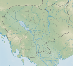 Phnom Dei Location of Phnom Dei in Cambodia | |
| Location | Phnom Srok District, Siem Reap Province, Cambodia |
| Geology | |
| Mountain type | Sandstone |
| Climbing | |
| Easiest route | Drive to Banteay Srei, then hike |

Phnom Dei (Khmer: ភ្នំដី) is a 272 m high hill close to Siem Reap, Cambodia.
Location[]
Phnom Dei is located to the southeast of the Banteay Srei, one of the major Angkorian temples, and south of Phnom Kulen. It is part of the temple complex in Angkor, the area that was the capital of the Khmer Empire.
Angkorian temple[]
There is a temple on top of the hill that was built during the reign of King Yasovarman I (889-910 AD).[2]: 65 [3]
Phnom Dei is only one of the hilltop temples built during King Yasovarman I's reign, the others being Phnom Bakheng, Phnom Bok and Phnom Krom.
References[]
- ^ Google Earth
- ^ Higham, C., 2001, The Civilization of Angkor, London: Weidenfeld & Nicolson, ISBN 9781842125847
- ^ Angkor Guide[permanent dead link]
External links[]
- Mercury diagram
- Nick Ray, Cambodia
This article about a building or structure in Cambodia is a stub. You can help Wikipedia by . |
 | This article about a Hindu place of worship is a stub. You can help Wikipedia by . |
Categories:
- Mountains of Cambodia
- Hindu temples in Siem Reap Province
- Geography of Siem Reap Province
- Angkorian sites in Siem Reap Province
- Cambodian building and structure stubs
- Hindu temple stubs