Pierpont, Missouri
Pierpont, Missouri | |
|---|---|
| Village of Pierpont | |
| Area | |
| • Total | 0.23 sq mi (0.59 km2) |
| • Land | 0.23 sq mi (0.59 km2) |
| • Water | 0.00 sq mi (0.00 km2) |
| Population | |
| • Total | 76 |
| • Estimate (2019)[3] | 75 |
| • Density | 328.95/sq mi (126.76/km2) |
| FIPS code | 29-57512 |
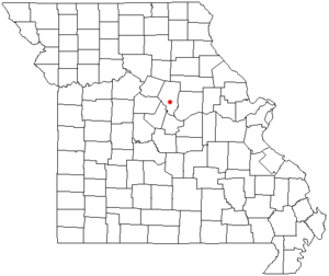
Pierpont is a village in Boone County, Missouri, United States.[4] It is part of the Columbia, Missouri Metropolitan Statistical Area. The population was 76 at the 2010 census. The village, located south of Rock Bridge Memorial State Park at Route N and Highway 163,[5] was incorporated in 2004 to avoid annexation by the city of Columbia. It is now an independent village with its own governing board of trustees.[6]
Geography[]
According to the United States Census Bureau, the village has a total area of 0.25 square miles (0.65 km2), all land.[7]
Demographics[]
| Historical population | |||
|---|---|---|---|
| Census | Pop. | %± | |
| 2010 | 76 | — | |
| 2019 (est.) | 75 | [3] | −1.3% |
| U.S. Decennial Census[8] | |||
2010 census[]
As of the census[2] of 2010, there were 76 people, 32 households, and 25 families residing in the village. The population density was 304.0 inhabitants per square mile (117.4/km2). There were 32 housing units at an average density of 128.0 per square mile (49.4/km2). The racial makeup of the village was 97.4% White, 1.3% African American, and 1.3% from two or more races.
There were 32 households, of which 25.0% had children under the age of 18 living with them, 75.0% were married couples living together, 3.1% had a male householder with no wife present, and 21.9% were non-families. 18.8% of all households were made up of individuals, and 9.4% had someone living alone who was 65 years of age or older. The average household size was 2.38 and the average family size was 2.72.
The median age in the village was 54.3 years. 19.7% of residents were under the age of 18; 4% were between the ages of 18 and 24; 14.4% were from 25 to 44; 35.5% were from 45 to 64; and 26.3% were 65 years of age or older. The gender makeup of the village was 52.6% male and 47.4% female.
References[]
- ^ "2019 U.S. Gazetteer Files". United States Census Bureau. Retrieved July 26, 2020.
- ^ a b "U.S. Census website". United States Census Bureau. Retrieved 2012-07-08.
- ^ a b "Population and Housing Unit Estimates". United States Census Bureau. May 24, 2020. Retrieved May 27, 2020.
- ^ U.S. Geological Survey Geographic Names Information System: Pierpont, Missouri
- ^ Ashland, Missouri, 7.5 Minute Topographic Quadrangle, USGS, 1969 (1982 rev.)
- ^ "Tinier towns hold onto identities as county develops". Columbia Daily Tribune. 2007-06-17. Archived from the original on 2007-09-27. Retrieved 2007-08-06.
- ^ "US Gazetteer files 2010". United States Census Bureau. Archived from the original on 2012-01-24. Retrieved 2012-07-08.
- ^ "Census of Population and Housing". Census.gov. Retrieved June 4, 2015.
Municipalities and communities of Boone County, Missouri, United States | ||
|---|---|---|
| Cities |  | |
| Villages | ||
| Townships | ||
| Unincorporated communities | ||
| Ghost towns | ||
| Footnotes | ‡a small part of Centralia is in Audrain County | |
| ||
Coordinates: 38°51′44″N 92°18′54″W / 38.86222°N 92.31500°W

- Villages in Boone County, Missouri
- Columbia metropolitan area (Missouri)
- Villages in Missouri