Pinery, South Australia
| Pinery South Australia | |||||||||||||||
|---|---|---|---|---|---|---|---|---|---|---|---|---|---|---|---|
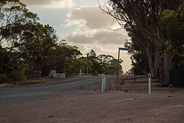 Corner of Thornton Road and Florence Street | |||||||||||||||
 Pinery | |||||||||||||||
| Coordinates | 34°18′34″S 138°27′26″E / 34.30944°S 138.45722°ECoordinates: 34°18′34″S 138°27′26″E / 34.30944°S 138.45722°E | ||||||||||||||
| Population | 102 (2016 census)[1] | ||||||||||||||
| Postcode(s) | 5460 | ||||||||||||||
| Location | 70 km (43 mi) N of Adelaide | ||||||||||||||
| LGA(s) | Wakefield Regional Council | ||||||||||||||
| State electorate(s) | Narungga[2] | ||||||||||||||
| Federal division(s) | Grey | ||||||||||||||
| |||||||||||||||

Pinery is a locality in South Australia's lower Mid North.[3] At the 2006 census, Pinery had a population of 279[4] but the locality was included with the town of Owen in the 2011 census (population 634)[5] and residents were not counted separately. Both of those were a much larger area than the area which had 102 residents in 2016.[1]
See also[]
References[]
- ^ a b Australian Bureau of Statistics (27 June 2017). "Pinery". 2016 Census QuickStats. Retrieved 30 September 2020.

- ^ Narungga (Map). Electoral District Boundaries Commission. 2016. Retrieved 1 March 2018.
- ^ "Search result for Pinery, LOCB (ID: SA0055465)". Property Location Browser. Government of South Australia. Retrieved 26 November 2015.
- ^ Australian Bureau of Statistics (25 October 2007). "Pinery (State Suburb)". 2006 Census QuickStats. Retrieved 26 November 2015.
- ^ Australian Bureau of Statistics (31 October 2012). "Owen (State Suburb)". 2011 Census QuickStats. Retrieved 26 November 2015.
External links[]
This South Australia geography article is a stub. You can help Wikipedia by . |
Categories:
- Towns in South Australia
- South Australia geography stubs