Pittington Hill
| Pittington Hill | |
|---|---|
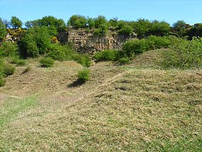 Disused Pittington Quarry, now part of Pittington Hill SSSI | |
 Location of Pittington Hill SSSI, Co Durham | |
| Location | County Durham, North East, England |
| Coordinates | 54°47′45″N 1°29′15″W / 54.79583°N 1.48750°WCoordinates: 54°47′45″N 1°29′15″W / 54.79583°N 1.48750°W |
| Area | 6.4 ha (16 acres) |
| Established | 1987 |
| Governing body | Natural England |
| Website | Map of site |

Pittington Hill is a Site of Special Scientific Interest in County Durham, England. It lies adjacent to the village of Pittington, some 6 km north-east of Durham city. A disused quarry occupies part of the site.
The hill slopes and former quarry support an extensive area of primary magnesian limestone grassland. Blue moor-grass, Sesleria albicans, a characteristic plant of such grassland, is present but not abundant in the primary grassland on the hill slopes, where herbs such as rock-rose, Helianthemum nummularium, are more common; blue moor-grass is more plentiful in the secondary grassland on the quarry floor and spoil heaps, where it is associated with species such as quaking grass, Briza media, salad burnet, Sanguisorba minor, and autumn gentian, Gentianella amarella.[1]
References[]
- ^ "Pittington Hill" (PDF). English Nature. 1987. Retrieved 31 July 2010.
This article about a Site of Special Scientific Interest in England is a stub. You can help Wikipedia by . |
This County Durham location article is a stub. You can help Wikipedia by . |
- Sites of Special Scientific Interest in County Durham
- Mountains and hills of County Durham
- Pittington
- English Site of Special Scientific Interest stubs
- County Durham geography stubs