Platteville, Wisconsin
Platteville, Wisconsin | |
|---|---|
City | |
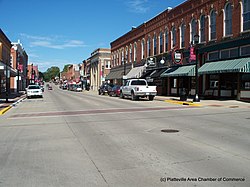 Platteville Main Street | |
 Location of Platteville in Grant County, Wisconsin. | |
| Coordinates: 42°44′13.45″N 90°28′39.01″W / 42.7370694°N 90.4775028°WCoordinates: 42°44′13.45″N 90°28′39.01″W / 42.7370694°N 90.4775028°W | |
| Country | |
| State | |
| County | Grant |
| Government | |
| • City Manager | Adam Ruechel[1] |
| Area | |
| • City | 6.18 sq mi (16.00 km2) |
| • Land | 6.18 sq mi (16.00 km2) |
| • Water | 0.00 sq mi (0.00 km2) |
| Elevation | 991 ft (302 m) |
| Population | |
| • City | 11,224 |
| • Estimate (2019)[4] | 12,087 |
| • Density | 1,956.46/sq mi (755.43/km2) |
| • Metro | 49,681 |
| Time zone | UTC-6 (CST) |
| • Summer (DST) | UTC-5 (CDT) |
| Area code(s) | 608 |
| FIPS code | 55-63250 |
| Website | http://www.platteville.org/ |

Platteville is the largest city in Grant County in southwestern Wisconsin. The population was 11,224 at the 2010 census, growing 12% since the 2000 Census. Much of this growth is likely due to the enrollment increase of the University of Wisconsin–Platteville. It is the principal city of the Platteville Micropolitan Statistical area, which has an estimated population of 49,681.
History[]
Platteville was a small farming and fur trading community established by European Americans along the Platte River, after which they named the town.[5]
In the 1820s, after galena, a type of lead ore, was discovered in the area, a significant mining boom occurred. The mining district eventually encompassed a significant portion of southwest Wisconsin, including the counties of Grant, Iowa, and Lafayette; and Jo Daviess County, Illinois. These were central to the exploitation and mining of lead and zinc ore. The Galena, Illinois mining district, an area south of Platteville, had been known to many for years.[6] Beginning in 1825, demand drove up the price of lead and the Platteville economy flourished.[7] The "grey gold" (a common nickname for lead ore) brought development of businesses and schools in the town. Platteville's landscape was shaped by the mining that helped build the town. Mineral holes abounded everywhere.[8]
By the 1849s lead ore production was decreasing. However, the mining of zinc ore quickly filled the void for prospective work. Platteville had become an established town, complete with schools, a private preparatory academy, newspaper, several churches, and a telegraph service as of November 1849.[9]
During this time, both a teachers' college and a mining college were founded. The Normal School was established on October 9, 1866 to train teachers for elementary school grades.[10] The Wisconsin Mining Trade School opened in January 1908.[11]
In 1959, these two colleges were merged to become Wisconsin State College and Institute of Technology.[11] Its curriculum was developed to add graduate programs and departments, particularly in engineering. In 1971 it was renamed as University of Wisconsin–Platteville, to reflect its expanded programs in graduate study. Other additions included criminal justice and, in the early 21st century, UW Platteville is also considered to have the best criminal justice college in the Midwest.[11]
From 1984 until 2001 the Chicago Bears football team held summer training camp on the campus of University of Wisconsin–Platteville. Their program resulted in a substantial infusion of money into the local economy each summer. The town felt the decline after the Bears moved their training camp to Olivet Nazarene University in Illinois.[citation needed]
In 2004, the University of Wisconsin System gave its approval to the University of Wisconsin–Platteville's plan to expand the student enrollment from 5,000 to 7,500.[citation needed]
In 2004, U.S. Highway 151 was upgraded to a limited-access highway; it bypassed the city south of Platteville. Prior to the upgrade, the highway exits were closer to Platteville. The city made changes to adjust to the new southern US 151 bypass, and it has influenced subsequent development. A new hospital was built just north of US 151 and next to its off ramps. A Walmart Supercenter and a Menards have opened near the northern end of the US 151 bypass.[citation needed]
Historic buildings[]
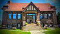
Former Carnegie library building
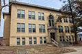
Ullrich Hall, part of the University of Wisconsin-Platteville


Economy[]
Platteville is a college town, with a population and economy strongly influenced by the university. It has had some development in the white-collar sector. That growth is a result of the increasing number of engineering firms locating in Platteville to take advantage of being associated with UW-P's engineering program.[citation needed]
Geography[]
Platteville is located at 42��44′13″N 90°28′39″W / 42.73707°N 90.477501°W (42.73707, -90.477501).[12] It is in the Hollow Region, as named by early southern miners, in the rolling hills of southwestern Wisconsin.
According to the United States Census Bureau, the city has a total area of 5.45 square miles (14.12 km2), all of it land.[13]
Platteville is serviced by Wisconsin State Highways 80 and 81, as well as U.S. Highway 151. Originally, U.S. 151 went through the valley that made up the southern border of the city limits, but with the completion of the four-lane limited-access superhighway, traffic has been rerouted and now loops south of the city.[citation needed]
The minerals in the area consist of galena, a sulfide of lead (lead 86.6, sulfur 13.4). Sphalerite or zinc sulfide is also, common in the region. Zinc and lead mining were in heavy production through the 1820s – 1920s.[14] Consequently, there are few straight streets in Platteville. As a result of the mining in the 1800s leaving a honeycomb of abandoned old mines, streets were located to avoid the mines.[citation needed]
Climate[]
| hideClimate data for Platteville, Wisconsin (1991–2020 normals, extremes 1872–present) | |||||||||||||
|---|---|---|---|---|---|---|---|---|---|---|---|---|---|
| Month | Jan | Feb | Mar | Apr | May | Jun | Jul | Aug | Sep | Oct | Nov | Dec | Year |
| Record high °F (°C) | 57 (14) |
65 (18) |
84 (29) |
93 (34) |
107 (42) |
102 (39) |
108 (42) |
105 (41) |
101 (38) |
93 (34) |
80 (27) |
67 (19) |
108 (42) |
| Average high °F (°C) | 25.7 (−3.5) |
30.8 (−0.7) |
43.3 (6.3) |
57.1 (13.9) |
68.7 (20.4) |
78.2 (25.7) |
81.8 (27.7) |
80.1 (26.7) |
73.2 (22.9) |
60.3 (15.7) |
44.6 (7.0) |
31.6 (−0.2) |
56.3 (13.5) |
| Daily mean °F (°C) | 17.8 (−7.9) |
22.3 (−5.4) |
34.1 (1.2) |
46.3 (7.9) |
57.9 (14.4) |
68.2 (20.1) |
71.8 (22.1) |
70.0 (21.1) |
62.2 (16.8) |
49.7 (9.8) |
36.3 (2.4) |
24.2 (−4.3) |
46.7 (8.2) |
| Average low °F (°C) | 9.9 (−12.3) |
13.7 (−10.2) |
24.8 (−4.0) |
35.4 (1.9) |
47.1 (8.4) |
58.3 (14.6) |
61.8 (16.6) |
59.8 (15.4) |
51.2 (10.7) |
39.1 (3.9) |
28.0 (−2.2) |
16.7 (−8.5) |
37.1 (2.8) |
| Record low °F (°C) | −43 (−42) |
−36 (−38) |
−28 (−33) |
7 (−14) |
26 (−3) |
33 (1) |
44 (7) |
35 (2) |
24 (−4) |
6 (−14) |
−21 (−29) |
−37 (−38) |
−43 (−42) |
| Average precipitation inches (mm) | 1.22 (31) |
1.47 (37) |
2.09 (53) |
3.95 (100) |
4.65 (118) |
5.97 (152) |
5.29 (134) |
4.23 (107) |
4.25 (108) |
2.82 (72) |
2.25 (57) |
1.79 (45) |
39.98 (1,015) |
| Average snowfall inches (cm) | 11.0 (28) |
9.8 (25) |
6.1 (15) |
1.6 (4.1) |
0.1 (0.25) |
0.0 (0.0) |
0.0 (0.0) |
0.0 (0.0) |
0.0 (0.0) |
0.4 (1.0) |
1.9 (4.8) |
11.9 (30) |
42.8 (109) |
| Average precipitation days (≥ 0.01 in) | 9.0 | 7.9 | 9.0 | 11.2 | 12.8 | 12.2 | 10.5 | 9.7 | 8.8 | 9.7 | 8.6 | 9.4 | 118.8 |
| Average snowy days (≥ 0.1 in) | 6.8 | 5.7 | 3.4 | 0.8 | 0.0 | 0.0 | 0.0 | 0.0 | 0.0 | 0.2 | 1.4 | 6.4 | 24.7 |
| Source: NOAA[15][16] | |||||||||||||
Demographics[]
| Historical population | |||
|---|---|---|---|
| Census | Pop. | %± | |
| 1870 | 2,537 | — | |
| 1880 | 2,687 | 5.9% | |
| 1890 | 2,740 | 2.0% | |
| 1900 | 3,340 | 21.9% | |
| 1910 | 4,452 | 33.3% | |
| 1920 | 4,353 | −2.2% | |
| 1930 | 4,047 | −7.0% | |
| 1940 | 4,762 | 17.7% | |
| 1950 | 5,751 | 20.8% | |
| 1960 | 6,957 | 21.0% | |
| 1970 | 9,599 | 38.0% | |
| 1980 | 9,580 | −0.2% | |
| 1990 | 9,708 | 1.3% | |
| 2000 | 9,989 | 2.9% | |
| 2010 | 11,224 | 12.4% | |
| 2019 (est.) | 12,087 | [4] | 7.7% |
| U.S. Decennial Census[17] | |||
2010 census[]
As of the census[3] of 2010, there were 11,224 people, 3,644 households, and 1,598 families residing in the city. The population density was 2,059.4 inhabitants per square mile (795.1/km2). There were 3,840 housing units at an average density of 704.6 per square mile (272.0/km2). The racial makeup of the city was 94.7% White, 2.1% African American, 0.2% Native American, 1.7% Asian, 0.3% from other races, and 1.0% from two or more races. Hispanic or Latino of any race were 1.6% of the population.
There were 3,644 households, of which 18.2% had children under the age of 18 living with them, 32.7% were married couples living together, 7.8% had a female householder with no husband present, 3.3% had a male householder with no wife present, and 56.1% were non-families. 31.4% of all households were made up of individuals, and 11.6% had someone living alone who was 65 years of age or older. The average household size was 2.32 and the average family size was 2.80.
The median age in the city was 22.4 years. 11.3% of residents were under the age of 18; 49.4% were between the ages of 18 and 24; 14.3% were from 25 to 44; 14.3% were from 45 to 64; and 10.7% were 65 years of age or older. The gender makeup of the city was 56.3% male and 43.7% female.
2000 census[]
As of the census[18] of 2000, there were 9,989 people, 3,312 households, and 1,692 families residing in the city. The population density was 2,376.4 people per square mile (918.3/km2). There were 3,482 housing units at an average density of 828.4 per square mile (320.1/km2). The racial makeup of the city was 96.15% White, 1.12% Black or African American, 0.27% Native American, 1.40% Asian, 0.04% Pacific Islander, 0.27% from other races, and 0.75% from two or more races. 0.88% of the population were Hispanic or Latino of any race. There were 3,312 households, out of which 22.2% had children under the age of 18 living with them, 40.0% were married couples living together, 8.0% had a female householder with no husband present, and 48.9% were non-families. 32.2% of all households were made up of individuals, and 13.0% had someone living alone who was 65 years of age or older. The average household size was 2.31 and the average family size was 2.86.
In the city, the population was spread out, with 14.4% under the age of 18, 41.3% from 18 to 24, 17.5% from 25 to 44, 14.4% from 45 to 64, and 12.3% who were 65 years of age or older. The median age was 23 years. For every 100 females, there were 119.3 males. For every 100 females age 18 and over, there were 120.6 males.
The median income for a household in the city was $35,742, and the median income for a family was $50,583. Males had a median income of $31,424 versus $21,896 for females. The per capita income for the city was $15,858. About 4.6% of families and 19.4% of the population were below the poverty line, including 12.2% of those under age 18 and 8.3% of those age 65 or over.
Transportation[]

Aside from Platteville Municipal Airport (KPVB), which serves the city and surrounding communities for general aviation, Platteville has minimal commercial air access. The closest airport with any regularly-scheduled commercial service is Dubuque Regional Airport, and the closest airport with regularly-scheduled commercial international flights is Chicago O'Hare International Airport.
Platteville's primary road access is via U.S. Route 151, which acts as an expressway for the region; US 151 has three exits near the city center. Wisconsin state routes 80 and 81 also serve Platteville, cutting through the central business district as sort of a "main street".
Platteville no longer has railroad service. It was previously served by the Chicago & Northwestern Railroad (C&NW) via an 8-mile branch off the Montfort Junction to Galena line at Ipswich. The line entered Platteville from the east-southeast and curved around to the north. The line then joined the Chicago, Milwaukee, St. Paul and Pacific (Milwaukee Road). This in effect created a large 180° curve in the southeastern part of Platteville where the mines, depots and other rail-dependent industries were located. The Milwaukee Road branch continued on to the ENE then east for 17 miles where it branched off another Milwaukee Road branch line to Mineral Point at the town of Calamine.[19] Passenger service ended on the C&NW in 1951 and was replaced by mixed train service on the Milwaukee Road in 1952. Freight service continued on the Milwaukee Road until 1974 when the line was abandoned and pulled up. It left the C&NW moving only a few cars per week which applied to abandon the route. The abandonment was granted in 1980 and the line was pulled up forever ending railroad service to Platteville.[20]
Education[]
The Platteville School District serves the Platteville area. Platteville High School is the area's public high school. Platteville High School's mascot is "Henry Hillmen". The University of Wisconsin–Platteville is located in Platteville.
Culture[]
The main source of culture in Platteville is the Center for the Arts on University of Wisconsin–Platteville campus, which sponsors a steady stream of well-attended professional touring events.
Attractions[]
- The Mining and Rollo Jamison Museums
At the museums one can tour Lorenzo Bevan's 1845 lead mine, ride a 1931 zinc mine train, and view many exhibits on Platteville's mining history as well as Rollo Jamison's personal collection of artifacts.[21]
- Stone Cottage
Built in 1837 by the Rev. Samuel Mitchell, this home still contains many of the original furnishings. The home was a home of the Major John Rountree, one of Platteville's founders. The walls are two feet thick and made of dolomite Galena limestone.[22]
- The Big M

The M is a monogram for the former Wisconsin Mining School (now the University of Wisconsin–Platteville).
The first M was first constructed in 1936 when two men, Raymond Medley and Alvin Knoerr climbed the Platte Mound and trudged through 2 feet of snow to form a huge letter M. Actual construction of the stone M began in the spring of 1937 and was completed in the fall of the same year.
The M is composed of rocks laid on Platte Mound and is whitewashed every year. The M is 241-feet tall, 214-feet wide and legs that are 25-feet wide.
The M can be seen many places in Platteville and sometimes in Iowa, on a clear day. Atop the Platte Mound and the M viewers can see three states: Wisconsin, Iowa, and Illinois.
The M is lit once a year during the University of Wisconsin – Platteville college homecoming.[22]
Notable people[]
- Scott Adams, early computer game publisher and designer
- Cosette Kies, librarian, writer, ad academic
- John Fiedler, voice actor and character actor in stage, film, television and radio[23]
- Herbert Spencer Gasser, physiologist and recipient of the Nobel Prize for Physiology or Medicine in 1944
- Geoff Herbach, novelist
- Herbert T. Perrin, U.S. Brigadier General and Distinguished Service Cross recipient
- Josiah Little Pickard, educator
- Pants Rowland, manager of 1917 World Series champion Chicago White Sox[24]
Politicians[]
- William Carter, Wisconsin State Representative
- S. Wesley Clark, Attorney General of South Dakota
- Kearton Coates, Wisconsin State Representative
- Thomas Cruson, Wisconsin Territorial legislator
- James Dolan, Wisconsin State Representative
- Ensign Dickinson, Wisconsin State Representative
- Charles E. Estabrook, Wisconsin Attorney General
- Neely Gray, Wisconsin territorial legislator and businessman
- John L. Grindell, Wisconsin State Representative
- Jon R. Guiles, Wisconsin State Representative
- James V. Holland, Wisconsin State Representative
- Thomas Jenkins, Wisconsin State Representative
- Arthur W. Kopp, U.S. Representative
- James B. McCoy, Wisconsin State Representative
- Duncan McGregor, Wisconsin State Representative
- Ray Meiklejohn, Canadian politician
- Jonathan Baker Moore, Wisconsin State Representative and Union Army general
- James William Murphy, U.S. Representative
- Hanmer Robbins, Wisconsin State Representative
- Gordon Roseleip, Wisconsin State Senator
- John H. Rountree, Wisconsin State Senator
- A. C. Schultz, Wisconsin State Representative
- George Slack, Wisconsin State Representative
- Harry E. Stephens, Wisconsin State Representative
- Robert S. Travis, Wisconsin State Senator
- Adelbert L. Utt, Wisconsin State Representative
- James Russell Vineyard, Wisconsin and California politician
- Noah Virgin, Wisconsin State Senator
- Benjamin Webster, Wisconsin State Representative
- Conrad J. Weittenhiller, Wisconsin State Representative
- Christopher C. Miller, Acting United States Secretary of Defense
Gallery[]
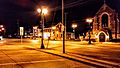
Downtown Platteville at night
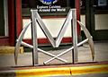
Bike rack depicting the Big M
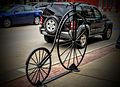
Bike rack in downtown Platteville

Rountree Hall apartment complex (former Mining school)

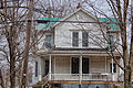
The William Parnell Building, part of the Main Street Commercial Historic District


See also[]
References[]
- ^ Platteville. City Manager
- ^ "2019 U.S. Gazetteer Files". United States Census Bureau. Retrieved August 7, 2020.
- ^ Jump up to: a b "U.S. Census website". United States Census Bureau. Retrieved 2012-11-18.
- ^ Jump up to: a b "Population and Housing Unit Estimates". United States Census Bureau. May 24, 2020. Retrieved May 27, 2020.
- ^ Chicago and North Western Railway Company (1908). A History of the Origin of the Place Names Connected with the Chicago & North Western and Chicago, St. Paul, Minneapolis & Omaha Railways. p. 114.
- ^ Nesbit, Robert. Wisconsin A History. 2nd ed. The University of Wisconsin Press: Madison, 1989.
- ^ Nesbit, 96.
- ^ Fatzinger, 16.
- ^ Hibbard, James. Images of America: PLATTEVILLE, Arcadia Publishing, 2004.
- ^ Hibbard, 37.
- ^ Jump up to: a b c Hibbard, 83.
- ^ "US Gazetteer files: 2010, 2000, and 1990". United States Census Bureau. 2011-02-12. Retrieved 2011-04-23.
- ^ "US Gazetteer files 2010". United States Census Bureau. Archived from the original on 2012-01-25. Retrieved 2012-11-18.
- ^ Fatzinger, Dale Rodger. "Historical Geography of Lead and Zinc Mining In Southwest Wisconsin 1820–1920: A Century of Change." PhD diss., Michigan State University, 1971.
- ^ "NowData – NOAA Online Weather Data". National Oceanic and Atmospheric Administration. Retrieved June 22, 2021.
- ^ "Station: Platteville, WI". U.S. Climate Normals 2020: U.S. Monthly Climate Normals (1991-2020). National Oceanic and Atmospheric Administration. Retrieved June 22, 2021.
- ^ "Census of Population and Housing". Census.gov. Retrieved June 4, 2015.
- ^ "U.S. Census website". United States Census Bureau. Retrieved 2008-01-31.
- ^ Lanz, Daniel J. Railroads of Southern and Southwestern Wisconsin Development to Decline, 2004, P 73
- ^ Schweiterman, Joseph B.; When a Railroad Leaves Town: American Communities in the Age of Rail Abandonment, v 2, , 1985, PP 293-294
- ^ "Attractions". Mining museum. Archived from the original on 2007-12-08. Retrieved 2009-12-23.
- ^ Jump up to: a b "Attractions". Platteville Chamber of Commerce. Archived from the original on 2010-01-09. Retrieved 2009-12-23.
- ^ O'Donnell, Michelle. "John Fiedler, 80, Stage Actor and Film Voice of Pooh's Piglet, Dies", New York Times, June 27, 2005. Accessed December 15, 2007.
- ^ "Pants Rowland Managerial Record".
External links[]
| Wikimedia Commons has media related to Platteville, Wisconsin. |
- City of Platteville
- Platteville Chamber of Commerce
- Platteville Mining Museum and Rollo Jamison Museum
- University of Wisconsin–Platteville
- Platteville Main Street Program
- Sanborn fire insurance maps: 1884 1892 1900 1908 1915
| show Municipalities and communities of Grant County, Wisconsin, United States |
|---|

| show Authority control |
|---|
- Cities in Wisconsin
- Cities in Grant County, Wisconsin
- Micropolitan areas of Wisconsin