Ponta João Ribeiro
| Ponta João Ribeiro | |
|---|---|
 The headland (indicated as Ribeira Julian Pt.) on an 1884 map | |
 | |
| Location | Northern São Vicente, Cape Verde |
| Coordinates | 16°54′22″N 24°59′56″W / 16.906°N 24.999°WCoordinates: 16°54′22″N 24°59′56″W / 16.906°N 24.999°W |
| Offshore water bodies | Porto Grande Bay, Canal de São Vicente |

Ponta João Ribeiro is a cape in the northern part of the island of São Vicente, Cape Verde. It is 2.5 km northwest of the city centre of Mindelo. The cape divides the Canal de São Vicente and the Porto Grande Bay. The islet of Ilhéu dos Pássaros is approximately 1.3 km to the west. Near the cape is an abandoned military camp.[1]
See also[]
References[]
- ^ João Ribeira on mindelo.info (in French)
The island of São Vicente | ||
|---|---|---|
| Communities and settlements | 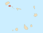 | |
| Mountains |
| |
| Streams |
| |
| Other geographical features | ||
| Topics | ||
| Culture | ||
Categories:
- Headlands of Cape Verde
- Geography of São Vicente, Cape Verde
- Mindelo