São Pedro, Cape Verde
São Pedro | |
|---|---|
Settlement | |
 | |
 São Pedro | |
| Coordinates: 16°49′26″N 25°03′36″W / 16.824°N 25.060°WCoordinates: 16°49′26″N 25°03′36″W / 16.824°N 25.060°W | |
| Country | Cape Verde |
| Island | São Vicente |
| Municipality | São Vicente |
| Civil parish | Nossa Senhora da Luz |
| Elevation | 22 m (72 ft) |
| Population (2010)[1] | |
| • Total | 991 |
| ID | 21107 |

São Pedro is a village in the southwestern part of the island of Sao Vicente, Cape Verde. It is situated on the south coast, approximately 10 km southwest of the island capital Mindelo. In 2010 its population was 991. Cesária Évora Airport, the island's international airport is directly north of São Pedro. It was mentioned as a small port as "P. St. Pedro" in the 1747 map by Jacques-Nicolas Bellin.[2] The lighthouse Farol de D. Amélia sits on the Ponta Machado, 3 km west of the village.

The village of São Pedro and its bay
References[]
- ^ "2010 Census results". Instituto Nacional de Estatística Cabo Verde (in Portuguese). 24 November 2016.
- ^ Jacques-Nicolas Bellin (1747). "Carte des Isles du Cap Verd = Kaart van de Eilanden van Kabo Verde" (in French).
External links[]
- Discover the Lighthouse (in French)
| hide The island of São Vicente | ||
|---|---|---|
| Communities and settlements | 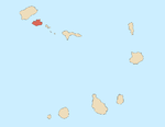 | |
| Mountains |
| |
| Streams |
| |
| Other geographical features | ||
| Topics | ||
| Culture | ||
Categories:
- Villages and settlements in São Vicente, Cape Verde
- Populated coastal places in Cape Verde