Ponta da Mina
| Ponta da Mina | |
|---|---|
 | |
| Location | Northeastern Príncipe near Santo António |
| Coordinates | 1°38′54″N 7°26′18″E / 1.64833°N 7.43833°ECoordinates: 1°38′54″N 7°26′18″E / 1.64833°N 7.43833°E |
| Offshore water bodies | Atlantic Ocean |
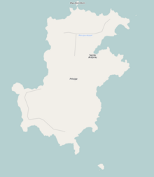
Ponta da Mina is a headland located some 2 km northeast of Santo António, the island capital of Príncipe in São Tomé and Príncipe. The point is on the southern shores of . It is fringed by rocks, and the ancient fortress Fortaleza de Santo António da Ponta da Mina stands at its summit.[1]
Located next to the fortress is a lighthouse, built in 1996.[2] Its focal height is 54 meters and its range is 9 nautical miles (17 km; 10 mi).[3]
References[]
- ^ Sailing Directions (Enroute), Pub. 123: Southwest Coast of Africa (PDF). Sailing Directions. United States National Geospatial-Intelligence Agency. 2017. p. 74.
- ^ Rowlett, Russ. "Lighthouses of São Tomé and Príncipe". The Lighthouse Directory. University of North Carolina at Chapel Hill. Retrieved 28 October 2018.
- ^ List of Lights, Pub. 113: The West Coasts of Europe and Africa, the Mediterranean Sea, Black Sea and Azovskoye More (Sea of Azov) (PDF). List of Lights. United States National Geospatial-Intelligence Agency. 2018. p. 441.
| Communities |  | |
|---|---|---|
| Geographical features | ||
| Buildings | ||
| Football | ||
This São Tomé and Príncipe geographical location article is a stub. You can help Wikipedia by . |
Categories:
- Príncipe
- Landforms of São Tomé and Príncipe
- São Tomé and Príncipe geography stubs