Poplar Grove Township, Boone County, Illinois
Poplar Grove Township | |
|---|---|
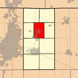 Location in Boone County | |
 Boone County's location in Illinois | |
| Coordinates: 42°22′11″N 88°49′22″W / 42.36972°N 88.82278°WCoordinates: 42°22′11″N 88°49′22″W / 42.36972°N 88.82278°W | |
| Country | United States |
| State | Illinois |
| County | Boone |
| Settlement | November 6, 1849 |
| Area | |
| • Total | 23.84 sq mi (61.7 km2) |
| • Land | 23.78 sq mi (61.6 km2) |
| • Water | 0.06 sq mi (0.2 km2) 0.25% |
| Elevation | 902 ft (275 m) |
| Population (2010) | |
| • Estimate (2016)[1] | 5,099 |
| • Density | 212.5/sq mi (82.0/km2) |
| Time zone | UTC-6 (CST) |
| • Summer (DST) | UTC-5 (CDT) |
| ZIP codes | 61008, 61011, 61012, 61065 |
| FIPS code | 17-007-61158 |

Poplar Grove Township is one of nine townships in Boone County, Illinois, USA. As of the 2010 census, its population was 5,054 and it contained 1,785 housing units.[2] Poplar Grove Township was formed from parts of Caledonia Township and Boone Township after 1921.
Geography[]
According to the 2010 census, the township has a total area of 23.84 square miles (61.7 km2), of which 23.78 square miles (61.6 km2) (or 99.75%) is land and 0.06 square miles (0.16 km2) (or 0.25%) is water.[2]
Cities[]
- Poplar Grove (north three-quarters)
- Timberlane (northeast quarter)
Unincorporated towns[]
Cemeteries[]
The township contains these five cemeteries: Clark, Ewins, Popular Grove, Russellville and South Poplar Grove.
Major highways[]
 Illinois State Route 76
 Illinois State Route 173
Demographics[]
| Historical population | |||
|---|---|---|---|
| Census | Pop. | %± | |
| 2016 (est.) | 5,099 | [1] | |
| U.S. Decennial Census[3] | |||
School districts[]
- Belvidere Consolidated Unit School District 100
- North Boone Community Unit School District 200
Political districts[]
- Illinois' 16th congressional district
- State House District 69
- State Senate District 35
References[]
- Sources
- "Poplar Grove Township, Boone County, Illinois". Geographic Names Information System. United States Geological Survey. Retrieved 2010-01-04.
- United States Census Bureau 2007 TIGER/Line Shapefiles
- United States National Atlas
- Notes
- ^ a b "Population and Housing Unit Estimates". Retrieved June 9, 2017.
- ^ a b "Population, Housing Units, Area, and Density: 2010 - County -- County Subdivision and Place -- 2010 Census Summary File 1". United States Census. Archived from the original on 2020-02-12. Retrieved 2013-05-28.
- ^ "Census of Population and Housing". Census.gov. Retrieved June 4, 2016.
External links[]
Places adjacent to Poplar Grove Township, Boone County, Illinois | ||||||||||||||||
|---|---|---|---|---|---|---|---|---|---|---|---|---|---|---|---|---|
| ||||||||||||||||
Municipalities and communities of Boone County, Illinois, United States | ||
|---|---|---|
| Cities | ||
| Villages | ||
| Townships | ||
| CDPs | ||
| Other communities | ||
| Ghost town | ||
| Footnotes | ‡This populated place also has portions in an adjacent county or counties | |
| ||
Categories:
- Townships in Boone County, Illinois
- Populated places established in 1849
- Townships in Illinois
- 1849 establishments in Illinois