Porcupine, South Dakota
Porcupine, South Dakota
pȟahíŋ siŋté | |
|---|---|
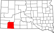
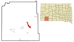 Location in Oglala Lakota County and the state of South Dakota | |
 Porcupine Location in Oglala Lakota County and the state of South Dakota | |
| Coordinates: 43°15′45″N 102°20′52″W / 43.26250°N 102.34778°WCoordinates: 43°15′45″N 102°20′52″W / 43.26250°N 102.34778°W | |
| Country | United States |
| State | South Dakota |
| County | Oglala Lakota |
| Area | |
| • Total | 9.5 sq mi (24.6 km2) |
| • Land | 9.5 sq mi (24.6 km2) |
| • Water | 0 sq mi (0 km2) |
| Elevation | 3,192 ft (973 m) |
| Population | |
| • Total | 1,062 |
| • Density | 111.8/sq mi (43.1/km2) |
| Time zone | UTC−7 (Mountain (MST)) |
| • Summer (DST) | UTC−6 (MDT) |
| ZIP code | 57772 |
| Area code(s) | 605 |
| FIPS code | 46-51340[2] |
| GNIS feature ID | 1257179[3] |


Porcupine (Lakota: pȟahíŋ siŋté; "porcupine tail") is a census-designated place (CDP) in Oglala Lakota County, South Dakota, United States. The population was 1,062 at the 2010 census.
The community most likely was named after Porcupine Butte.[4] Porcupine has been noted for its unusual place name,[5] and for its designation as the unofficial capital of the unrecognized Republic of Lakotah.
Geography[]
Porcupine is located at 43°15′45″N 102°20′52″W / 43.26250°N 102.34778°W (43.262380, -102.347660).[6]
According to the United States Census Bureau, the CDP has a total area of 9.5 square miles (24.6 km2), all land.
Porcupine has been assigned the ZIP code 57772.
Porcupine is also the unofficial capital of the unrecognized Republic of Lakotah.
Culture[]
Porcupine is home to KILI (90.1 FM), a non-profit radio station broadcasting to the Lakota people on the Pine Ridge, Cheyenne River, and Rosebud Indian Reservations, part of the Great Sioux Nation.[7][8] The station started broadcasting in 1983 as the first American Indian-owned radio station in the United States.[9]
Demographics[]


| Historical population | |||
|---|---|---|---|
| Census | Pop. | %± | |
| 1990 | 783 | — | |
| 2000 | 407 | −48.0% | |
| 2010 | 1,062 | 160.9% | |
| U.S. Decennial Census | |||
As of the census[2] of 2000, there were 407 people, 89 households, and 76 families residing in the CDP. The population density was 42.9 people per square mile (16.6/km2). There were 103 housing units at an average density of 10.8 per square mile (4.2/km2). The racial makeup of the CDP was 1.23% European American, 98.28% Native American, and 0.49% from two or more races. Hispanic or Latino of any race were 1.47% of the population.
There were 89 households, out of which 47.2% had children under the age of 18 living with them, 32.6% were married couples living together, 38.2% had a female householder with no husband present, and 13.5% were non-families. 9.0% of all households were made up of individuals, and 1.1% had someone living alone who was 65 years of age or older. The average household size was 4.57 and the average family size was 4.83.
In the CDP, the population was spread out, with 42.0% under the age of 18, 13.5% from 18 to 24, 21.6% from 25 to 44, 18.9% from 45 to 64, and 3.9% who were 65 years of age or older. The median age was 21 years. For every 100 females, there were 110.9 males. For every 100 females age 18 and over, there were 114.5 males.
The median income for a household in the CDP was $24,583, and the median income for a family was $26,667. Males had a median income of $26,786 versus $26,250 for females. The per capita income for the CDP was $4,429. About 30.8% of families and 28.8% of the population were below the poverty line, including 29.1% of those under age 18 and none of those age 65 or over.
Radio station[]
KILI FM 90.1, is licensed to Porcupine. Broadcasting to the Lakota people on the Pine Ridge, Cheyenne River, and Rosebud Indian Reservations, part of the Great Sioux Nation. It started broadcasting in 1983 as the first American Indian-owned radio station in the United States. At the end of 2008, KILI announced on its website that the station would be powered by a wind turbine.
Education[]
Oglala Lakota County School District is the public school district.[10] Lakota Tech High School is the public high school.
A campus of Red Cloud Indian School, Our Lady of Lourdes Elementary School (Lakota: Wíŋyaŋ Wakȟáŋ Owáyawa), is adjacent to the Porcupine CDP and has a Porcupine address.[11] It was established in 1929, and became a part of the Red Cloud System in 1931.[12]
Notable people[]
- Old Chief Smoke, an original Oglala Sioux head chief. He is buried southeast of Porcupine.
- Russell Means, an American Indian Movement activist and actor. As "a grandfather with twenty-two grandchildren" Russell Means ... "[divided] his time between Chinle, Navajo Nation, Arizona, and Porcupine."[13] In December 2007, while a resident of Porcupine, he joined with members of the American Indian Movement, and "dropped in on the State Department and the embassies of Bolivia, Venezuela, Chile and South Africa ... seeking recognition for their effort to form a free and independent Lakota nation," to be known as the Republic of Lakotah.[14]
- Edgar Bear Runner - Citizen used by the FBI to negotiate with AIM occupiers during the Wounded Knee incident, survivor of the Pine Ridge Reign of Terror carried out by FBI, local law enforcements, and the paramilitary GOONs. Activist who lobbies for the clemency of AIM activist Leonard Peltier for his alleged crimes during the Wounded Knee incident.
References[]
| Wikimedia Commons has media related to Porcupine, South Dakota. |
- ^ "2010 Census Redistricting Data (Public Law 94-171) Summary File". American FactFinder. United States Census Bureau. Archived from the original on 11 April 2015. Retrieved 10 May 2012.
- ^ Jump up to: a b "U.S. Census website". United States Census Bureau. Retrieved 2008-01-31.
- ^ "US Board on Geographic Names". United States Geological Survey. 2007-10-25. Retrieved 2008-01-31.
- ^ Federal Writers' Project (1940). South Dakota place-names, v.1-3. University of South Dakota. p. 56.
- ^ Petras, Kathryn; Petras, Ross (18 December 2007). Unusually Stupid Americans: A Compendium of All-American Stupidity. Random House Publishing Group. p. 246. ISBN 978-0-307-41761-9.
- ^ "US Gazetteer files: 2010, 2000, and 1990". United States Census Bureau. 2011-02-12. Retrieved 2011-04-23.
- ^ David Melmer (2006-05-22). "KILI-FM radio off the air". Indian Country Today. Archived from the original on 2008-06-19. Retrieved 2008-04-06.
- ^ "KILI Radio – Pine Ridge Indian Reservation". Lakota Express. Retrieved 2008-04-01.
- ^ "Russell Means". Treaty Productions. 1996. Retrieved 2008-04-06.
- ^ "2020 CENSUS - SCHOOL DISTRICT REFERENCE MAP: Oglala Lakota County, SD" (PDF). U.S. Census Bureau. Retrieved 2021-08-01.
- ^ "Contact Us". Retrieved 2021-08-01.
500 Lourdes Lane Porcupine, South Dakota 57772
- Compare with the CDP map - ^ "About Our Lady of Lourdes". Our Lady of Lourdes Elementary School. Retrieved 2021-08-01.
- ^ Means, Russell; Marvin J Wolf (1995). Where white men fear to tread: the autobiography of Russell Means. New York: St. Martin's Press. ISBN 9780312136215.
- ^ Jones, Ebony (2007-12-30). "Lakota Indians want to break free from the U.S." UrbanSwirl.com - Lifestyles of Color. Archived from the original on 2014-10-12. Retrieved 2014-10-12.
| show Municipalities and communities of Oglala Lakota County, South Dakota, United States |
|---|
| show Authority control |
|---|
- Census-designated places in Oglala Lakota County, South Dakota
- Census-designated places in South Dakota
- Pine Ridge Indian Reservation