Port Ballona, California
Port Ballona | |
|---|---|
 La Ballona map of 1896, present day location of Playa del Rey, Marina del Rey, and the Ballona Wetlands. | |
| Coordinates: 33°58′46″N 118°27′10″W / 33.97944°N 118.45278°WCoordinates: 33°58′46″N 118°27′10″W / 33.97944°N 118.45278°W | |
| Elevation | 16 ft (5 m) |
| Time zone | UTC-8 (Pacific (PST)) |
| • Summer (DST) | UTC-7 (PDT) |

Port Ballona was situated, from circa 1859 to 1903, near the center of Santa Monica Bay in coastal Los Angeles County, where currently Playa Del Rey and Del Rey Lagoon is located. The name comes from the Mexican La Ballona land grant. Port Ballona consisted of the current Del Rey Lagoon Park but conceptually embraced including the current Ballona Wetlands State Ecological Reserve. The estuarine river, Ballona Creek flows into the marsh and alongside the marsh within earthen levees that are soft-bottomed wetland soil.[1]
History[]
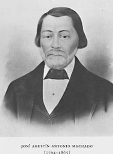
In 1839, the Mexican government granted the Machados and Talamantes title to Rancho La Ballona[2][3][4] In 1857, Benjamin D. Wilson, the first mayor of Los Angeles, through foreclosure received title to 1/4 of Rancho La Ballona.[5] Later, in 1859, Wilson, for $5000, sold 3,480 acres (1,410 ha) of Rancho La Ballona to George A. Sanford and John D. Young. During the Civil War, General George Wright ordered troops to secure Port Ballona against any Confederacy invasion; by 1862, a large force of 6,000 Union troops were at and near Port Ballona. The troop camp was called Camp Latham after Milton Latham.[6]
The Great Flood of 1862 turned the Port and the land around it into a swamp for six months.[7][8]

In 1863, Louis Mesmer sold his Los Angeles bakery and purchased extensive land holdings from the Machados, including Port Ballona. In 1887, Louis Mesmer and Moye Wicks made a small Port Harbor at Port Ballona. Moye Wicks starts the Ballona Harbor and Improvement Company in 1887, with plans to make the port a major sea port. August 21, 1887, the Town of Port Ballona was developed by Louis Mesmer and Moye Wicks. By 1889, Ballona Harbor and Improvement Company was out of funds to complete the maintain and expand the port, they could not keep the Port open. Louis Mesmer and Moye Wicks sold the port and land around the port to Moses Sherman. Sherman purchased 1,000 acres (400 ha) of land around the Ballona lagoon and the Port Ballona in 1902 under the name, Beach Land Company.[9]
Port Ballona rail depot was built at the port and serviced by the California Central Railway opening in September 1887; this line later became the Santa Fe Railway, that later became the Atchison, Topeka, and Santa Fe Railroad. The rail line ran from the port to Redondo junction[10]
Sherman and Clark renamed the port and land around the port to "Del Rey" in 1903. Port Ballona, in 1903, was renamed Playa Del Rey by Sherman and Clark. Port Ballona Street car depot, built by Sherman's Redondo and Hermosa Beach Railroad, was part of the Los Angeles Pacific Railroad. The Sherman's tram line opened in December 1902, it departed Downtown Los Angeles at 4th & Broadway.[11][12]
In the 1880s and 1890s, parts of Venice, Playa Vista, Culver City, and Mar Vista were also part of Port Ballona.[13]


See also[]
- Port of Los Angeles Long Wharf Santa Monica
- Port of Los Angeles San Pedro
- Port of Long Beach
References[]
- ^ delreync.org, Del Rey history Archived 2014-07-14 at the Wayback Machine
- ^ diseno Rancho La Ballona
- ^ 1900 USGS topographic map[permanent dead link]
- ^ Map of old Spanish and Mexican ranchos in Los Angeles County
- ^ Ranchos and the Politics of Land Claims Archived 2016-01-29 at the Wayback Machine by Karen Clay and Werner Troesken
- ^ "lacwrt.org, LA Civel War, Camp Latham, California, Brig. Gen. George Wright, USA, by D J "Duke"Dukesherer, Sr". Archived from the original on 2011-01-24. Retrieved 2014-08-11.
- ^ William H. Brewer, Up and down California in 1860-1864, New Haven, Yale University Press, 1930, p. 243 Retrieved 23 October 2010.
- ^ "Tips for Surviving a Mega-Disaster". NPR.org.
- ^ Mar Vista Historical Society
- ^ wikimapia.org, Amtrak Redondo Junction Maintenance Facility
- ^ erha.org Los Angeles Pacific Corporate Histories
- ^ delreync.org, Del Rey Neighborhood Council, Marina Del Rey History Archived 2014-07-14 at the Wayback Machine
- ^ Mar Vista Historical Society

- Former settlements in Los Angeles County, California
- Marina del Rey, California
- Playa del Rey, Los Angeles
- Populated coastal places in California
- Populated places established in 1839
- Populated places disestablished in 1903
- 1839 establishments in Alta California
- 1903 disestablishments in California
- 19th century in Los Angeles