Posey Township, Fayette County, Indiana
Posey Township | |
|---|---|
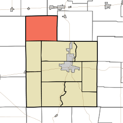 Location of Posey Township in Fayette County | |
| Coordinates: 39°44′42″N 85°14′34″W / 39.74500°N 85.24278°WCoordinates: 39°44′42″N 85°14′34″W / 39.74500°N 85.24278°W | |
| Country | United States |
| State | Indiana |
| County | Fayette |
| Government | |
| • Type | Indiana township |
| Area | |
| • Total | 31.15 sq mi (80.7 km2) |
| • Land | 31.1 sq mi (81 km2) |
| • Water | 0.05 sq mi (0.1 km2) |
| Elevation | 1,050 ft (320 m) |
| Population (2010) | |
| • Total | 508 |
| • Density | 16.3/sq mi (6.3/km2) |
| FIPS code | 18-61308[2] |
| GNIS feature ID | 453762 |

Posey Township is one of nine townships in Fayette County, Indiana. As of the 2010 census, its population was 508 and it contained 202 housing units.[3]
History[]
Posey Township was organized in 1823.[4] It was named for Governor Thomas Posey.[5]
The William Lowry House was added to the National Register of Historic Places in 1982.[6]
Geography[]
According to the 2010 census, the township has a total area of 31.15 square miles (80.7 km2), of which 31.1 square miles (81 km2) (or 99.84%) is land and 0.05 square miles (0.13 km2) (or 0.16%) is water.[3]
Unincorporated towns[]
(This list is based on USGS data and may include former settlements.)
Adjacent townships[]
- Dudley Township, Henry County (north)
- Jackson Township, Wayne County (northeast)
- Washington Township, Wayne County (east)
- Harrison Township (southeast)
- Fairview Township (south)
- Washington Township, Rush County (west)
Cemeteries[]
The township contains several cemeteries, the largest of which is adjacent to the Bentonville Christian Church. The remaining cemeteries are predominantly small family plots dating back to the 1800s.
References[]
- ^ "US Board on Geographic Names". United States Geological Survey. 2007-10-25. Retrieved 2008-01-31.
- ^ "U.S. Census website". United States Census Bureau. Retrieved 2008-01-31.
- ^ a b "Population, Housing Units, Area, and Density: 2010 - County -- County Subdivision and Place -- 2010 Census Summary File 1". United States Census. Archived from the original on 2020-02-12. Retrieved 2013-05-10.
- ^ History of Fayette County, Indiana. Warner, Beers and Company. 1885. pp. 222.
- ^ Barrows, Frederic Irving (1917). History of Fayette County, Indiana: Her People, Industries and Institutions. Bowen, B. F. p. 261.
- ^ "National Register Information System". National Register of Historic Places. National Park Service. July 9, 2010.
External links[]
Municipalities and communities of Fayette County, Indiana, United States | ||
|---|---|---|
| City | ||
| Town | ||
| Townships | ||
| Unincorporated communities | ||
| Footnotes | ‡This populated place also has portions in an adjacent county or counties | |
| ||
This Fayette County, Indiana location article is a stub. You can help Wikipedia by . |
- Townships in Fayette County, Indiana
- Townships in Indiana
- Central Indiana geography stubs